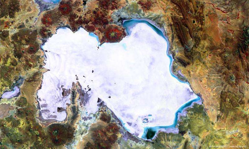
Image: Proba-V images Salar de Uyuni

Proba-V captures Bolivia's Salar de Uyuni, the world's largest salt plain – its 10 500 sq km make it larger than some countries.
Located in the highlands of southwestern Bolivia at an altitude of 3650 m, Salar de Uyuni is also extremely flat, varying less than 1 m across its expanse. It is so flat that it is often used to calibrate laser and radar altimeters on satellites.
The salt plains were formed 42 000–30 000 years ago as a result of transformations between several prehistoric lakes. The crusty top layer, several metres thick in places, lies on a brine rich in lithium (containing 50–70% of the world's reserves), potassium and magnesium.
The false-colour Proba-V image was acquired on 5 April 2017. On the western side of the Salar de Uyuni, some wavy patterns are visible, while blue shades on the northern and eastern edges indicate flooded areas. The small rectangular patches to the south of the salt flat indicate a large lithium mining area.
Launched on 7 May 2013, Proba-V is a miniaturised ESA satellite tasked with a full-scale mission: to map land cover and vegetation growth across the entire planet every two days.
Its main camera's continent-spanning 2250 km swath width collects light in the blue, red, near-infrared and mid-infrared wavebands at 300 m resolution and down to 100 m resolution in its central field of view.
Provided by European Space Agency


