NASA sees Tropical Cyclone Donna shearing apart

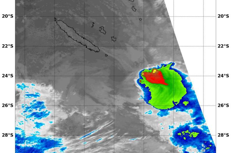
NASA's Terra satellite captured an infrared image of Tropical Cyclone Donna as it was being sheared apart by winds southeast of New Caledonia.
An infrared image taken May 10 at 11:55 UTC (7:55 a.m. EDT), from the MODIS instrument aboard NASA's Terra satellite showed cloud top temperatures of the dying storm. Strongest thunderstorms with cloud tops so high in the troposphere they were as cold as minus 70 degrees Fahrenheit (minus 56.6 degrees Celsius) were pushed to the southeast of the center from northwesterly wind shear.
The Joint Typhoon Warning Center issued their final warning on Donna today, May 10 at 0900 UTC (5 a.m. EDT). At that time, Donna's maximum sustained winds had dropped to 35 knots (40 mph/62 kph) and it was weakening. It was located about 116 nautical miles east-southeast of Noumea, New Caledonia, near 22.9 degrees south latitude and 168.0 degrees east longitude. Donna was moving southeast and is dissipating.
Provided by NASA's Goddard Space Flight Center


