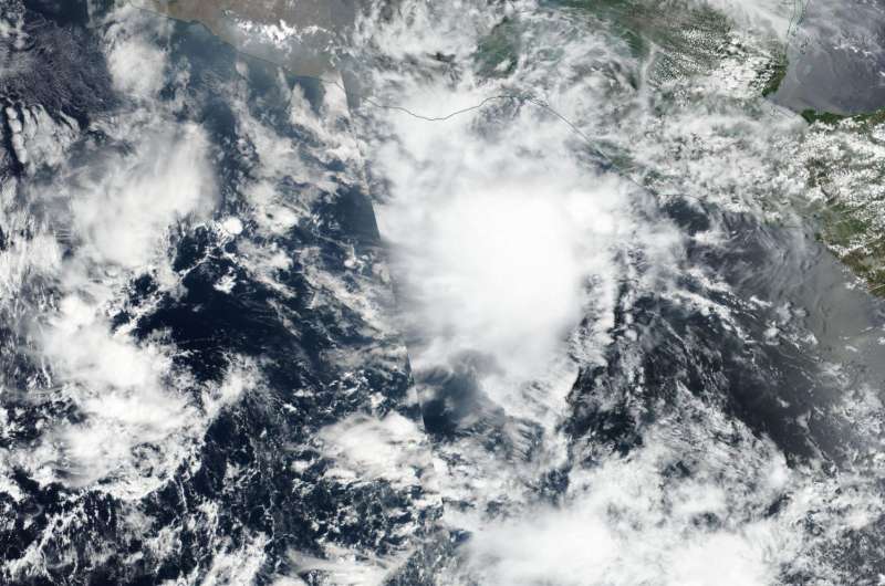
NASA caught Tropical Storm Adrian quickly losing steam

The first tropical storm of the Eastern Pacific Ocean season was already losing steam when the Suomi NPP satellite passed overhead the day it formed. By the next day, May 11, Tropical Storm Adrian weakened to a remnant low pressure area.
After Tropical Storm Adrian reached tropical storm stage on May 10 the Visible Infrared Imaging Radiometer Suite (VIIRS) instrument aboard NASA-NOAA's Suomi NPP satellite provided a visible-light image of the storm. The VIIRS imagery showed a concentration of strong thunderstorms around the low-level circulation center. The center of Adrian was in the Gulf of Tehuantepec, off-shore from southwestern Mexico
By 5 a.m. EDT on May 11, Adrian had weakened to a depression. At that time the depression was located about 385 miles (615 km) south-southeast of Salina Cruz Mexico. Five hours later, NOAA's National Hurricane Center (NHC) issued the final advisory on Adrian as the storm weakened even further into a remnant low pressure area.
At 11 a.m. EDT (1500 UTC), NHC noted that the center of Post-Tropical Cyclone Adrian was located near latitude 11.3 North and longitude 93.8 West. The post-tropical cyclone was moving toward the northwest near 7 mph (11 kph) and a gradual turn toward the west-northwest is expected over the next 48 hours. Maximum sustained winds dropped to near 30 mph (45 kph) with higher gusts. Some weakening is forecast during the next 48 hours. The estimated minimum central pressure is 1008 millibars.
NHC forecaster Richard Pasch noted in a discussion that the "Adrian consists of a rather insignificant-looking swirl of low clouds with just a few isolated showers. The system has been devoid of significant deep convection since yesterday afternoon, so
it is being declared a remnant low." Thus ends the life of the first tropical storm of the Eastern Pacific Ocean hurricane season, just one day after it formed.
Provided by NASA's Goddard Space Flight Center


