Londoners among most likely to feel ground move beneath feet

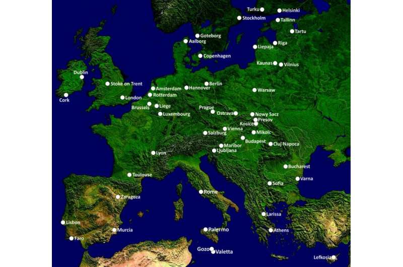
London tops the table of 52 European cities for the number of people exposed to possible ground instability, according to a new study.
The research, from an earth scientist at the University of Portsmouth, is the first to examine the distribution of geological hazards – from volcanoes and landslides, to subsidence and mining – across a number of Europe's largest cities.
London has the highest number of people exposed to such hazards, largely because of population density and the city's clay foundations that can shrink and swell with the seasons, sometimes seen as subsidence. The city also suffers exposure to another seven types of geohazard.
Researcher Renalt Capes said: "It's been known for many years that London's underlying geology has the potential to be hazardous, but until now we didn't know London would top the league for the most people exposed to geohazards out of the 52 European cities studied."
Mr Capes' study also found that Amsterdam and Rotterdam have, at 95 per cent, the highest proportion of land at risk from geohazards; in their case, due mainly to peat oxidation, compressible ground and gas production, all of which also have the potential to cause damage to buildings and infrastructure
Geohazards is a term covering a wide range of geological phenomena that have the potential to cause harm to property or people. With some exceptions, geohazards involve unstable ground.
Mr Capes ranked the cities according to population exposure, extent of the areas affected, and the number of geohazards, among other factors. He found 1,286 separate areas of geohazard, exposing 32 million people in total. On average, cities had four potential hazards.
Geohazards range from fast-moving events, such as landslides, earthquakes or collapses associated with dissolution, to slow moving shifts as small as a few millimetres a year, many of which may remain hidden beneath buildings until some visible damage occurs.
For many Europeans, including authorities with environmental responsibility, this might be the first time that they've heard of the possible hazards lying beneath their feet, homes and workplaces.

Mr Capes said: "All geohazards, or ground instabilities would usually represent some risk in an urban scenario, however small, and need to be mitigated against in the design of buildings and infrastructure.
"While a city with only one potential hazard could be the next one to experience a major geological disaster, which is possible if one thinks of the devastating effects of landslides, volcanoes or earthquakes, a city with numerous potential hazards could escape disasters entirely, and this research in no way attempts to prioritise or assess the risk posed by any particular geohazard.
Much of the data presented has only been made possible by the advent of a satellite-based technique known as 'radar interferometry' (InSAR) that has the capability to map mm-scale ground movements over wide areas. Before this technology, the true extent and distribution of geohazards in these 52 cities was largely unknown, and most mapping made was by 'geological susceptibility' or as a reaction to building damage.
InSAR measurements show line of sight displacements between the satellite and the ground with "amazing precision". Such displacements don't necessarily mean a problem is brewing and the data requires careful interpretation by experts alongside other data before any conclusions can be drawn.
Discussing whether the findings could threaten future major infrastructure work, including high speed rail and multi-storey buildings, Mr Capes was reassuring: "Modern engineering practices can overcome most geohazard obstacles. For example, foundations can be sunk to bedrock, as with London's Shard; bridges can be built to accommodate tectonic displacements, as in the Rio Antirio Bridge in Greece; and buildings can be built to withstand earthquakes.
"Satellite radar interferometry represents a new type of tool that can help save costs and improve safety," he said. "For example, for a relatively low cost, the entire length of the proposed high-speed rail-link could be InSAR-mapped during the feasibility stage to aid engineering planning, and then the line regularly monitored for stability during use. Crossrail are doing exactly this and using InSAR over the next five years to help monitor the new line crossing London."
In London, the shrinking and swelling of the underlying clay, which can cause damage to buildings and infrastructure, is estimated to have caused losses of £11bn between 1971 and 2009.
Indications are that future climate change will have an increasingly adverse effect on shrink-swell soils and, therefore, on the damage caused to homes, buildings and roads.
The Association of British Insurers predicts that subsidence claims will reach £600m a year by 2050 and the AA, which monitors over 40 different home insurers, is predicting that the average home insurance premium will rise significantly in the years ahead.
This new research is based upon the output from an EC-funded project proposed and led by Mr Capes that used satellite radar interferometry to map the unstable ground in 52 of Europe's largest cities – www.pangeoproject.eu .
Provided by University of Portsmouth


