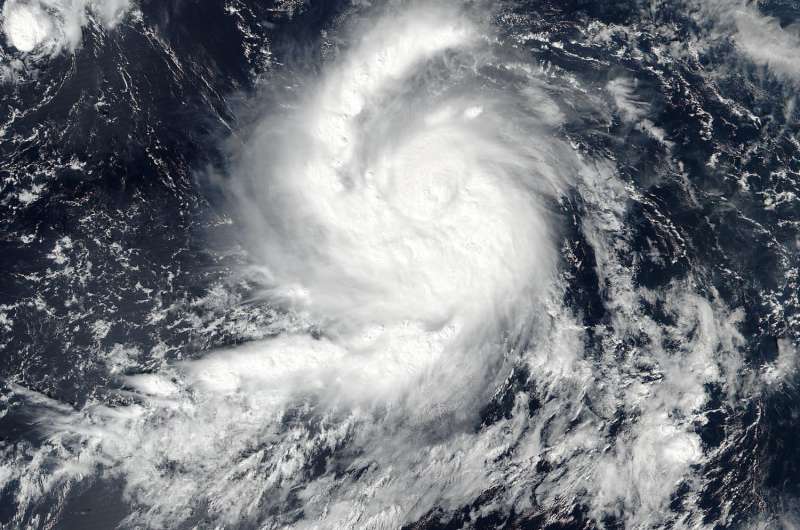
NASA sees Hurricane Seymour becoming a major hurricane

Hurricane Seymour was strengthening into a major hurricane in the Eastern Pacific Ocean when the NASA-NOAA Suomi NPP satellite passed over it from space.
On Oct. 24 at 4:50 p.m. EDT (20:50 UTC) the Visible Infrared Imaging Radiometer Suite (VIIRS) instrument aboard NASA-NOAA's Suomi NPP satellite provided a visible-light image of the storm. The image showed tight bands of thunderstorms wrapped around the low-level center of circulation and a large band of powerful thunderstorms wrapped into the center from the western quadrant. At time Suomi NPP passed overhead, Seymour was a Category 2 hurricane as maximum sustained winds rapidly increased to near 100 mph (155 kph)
Within the hour after Suomi NPP passed overhead, Forecaster Kimberlain of the National Hurricane Center (NHC) noted "Seymour is rapidly intensifying. A pinhole eye has formed within a small, nearly symmetric, central dense overcast (CDO) during the last several hours. In addition, a long curved band coils inward toward the center with a dry slot between it and the CDO."
Seymour continued to quickly intensify. By 5 a.m. EDT (0900 UTC) on Oct. 25 Seymour became a major hurricane, attaining Category 3 status on the Saffir-Simpson Hurricane Wind Scale. The maximum sustained winds have increased to near 115 mph (185 kph) with higher gusts. Additional strengthening is expected today, but Seymour is forecast to begin weakening on Wednesday, Oct. 26.
At that time, the NHC said the small eye of Hurricane Seymour was located near 15.6 degrees north latitude and 113.8 degrees west longitude. That puts the eye of the storm about 565 miles (910 km) south-southwest of the southern tip of Baja California, Mexico.
Seymour is moving toward the west near 15 mph (24 kph). A west to west-northwest motion is expected through tonight. A turn toward the northwest is forecast to occur on Wednesday.
For updates on Seymour, visit the NHC website: http://www.nhc.noaa.gov.
Provided by NASA's Goddard Space Flight Center


