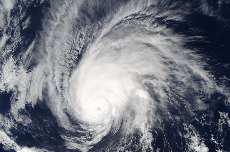
Aqua satellite spots Hurricane Seymour on fast weakening trend

NASA's Aqua satellite passed Hurricane Seymour as it embarked on a fast weakening trend in the Eastern Pacific Ocean.
On Oct. 26 at 5:20 p.m. EDT (21:20 UTC) the Moderate Resolution Imaging Spectroradiometer or MODIS instrument aboard NASA's Aqua satellite captured a visible light image of Hurricane Seymour that showed its eye had become cloud-filled. At the time maximum sustained winds had dropped to 125 mph (205 kph) and Seymour was weakening quickly.
The MODIS image showed the strongest thunderstorms were no longer symmetric in the storm. When a storm becomes asymmetric it's a sign it's weakening. To understand what happens when a tropical cyclone becomes asymmetric, think of a storm as a tire. If it isn't rounded it doesn't spin as fast.
At 5 a.m. EDT (0900 UTC) on Thursday, Oct. 27 the center of Hurricane Seymour was located near 19.5 degrees north latitude and 122.1 degrees west longitude. Seymour remains far from land and is centered about 820 miles (1,320 km) west-southwest of the southern tip of Baja California, Mexico.
The National Hurricane Center (NHC) said Seymour is moving toward the north-northwest near 12 mph (19 kph) and a turn to the north is expected today, followed by a northeastward motion on Friday, Oct. 28. The estimated minimum central pressure is 980 millibars.
Maximum sustained winds have decreased to near 90 mph (150 kph) with higher gusts. Rapid weakening is expected.
Seymour is forecast to weaken to a tropical storm this afternoon and become a remnant low pressure system on Friday.
For updated forecasts, visit the National Hurricane Center website: http://www.nhc.noaa.gov.
Provided by NASA's Goddard Space Flight Center


