NASA, partners track rain, snow in soggy Washington
")
Using everything from a customized DC-8 jetliner to ground radars to four-inch rain gauges, scientists are fanning out across one of the soggiest places in the United States this month to measure raindrops and snowflakes like never before.
Led by NASA and the University of Washington, the field experiment on the Olympic Peninsula attempts to validate, on the ground, how well global satellites measure precipitation from space, which is crucial for areas of the world that lack rain gauges or other equipment.
The four-month long OLYMPEX project will collect detailed atmospheric data—right down to the size of raindrops—that fall over the ocean, along the coast, in the foothills and the rugged Olympic Mountains. Ground instruments have already started collecting data and NASA's DC-8, a flying science laboratory, arrives in Washington state this week.
The idea is "to connect the dots between what we're seeing on the surface and what we're seeing from space and what we're seeing in the clouds," said Walt Petersen, NASA's deputy project scientist for ground validation.
Specifically, the scientists are making sure that global measurements made by a group of satellites are accurate; those satellites are part of a joint mission of NASA and the Japan Aerospace Exploration Agency that launched last year.
")
"There are a lot of parts in the globe where there are no weather radars and no capability to put radars or a rain gauge in," Petersen said, adding that such places rely on satellite weather forecasting.
So those satellites need to be able to accurately detect heavy tropical rain, light snowfall and other forms of precipitation. Such information would improve forecasting for floods and droughts as well as management of water resources.
The Olympic Peninsula, home to a protected temperate rain forest, is an ideal for the project because it's in the middle of an active winter storm track, said Lynn McMurdie, a UW researcher and one of the project's lead scientists.
It's reliably wet on the peninsula, which typically receives more than 8 feet (240 centimeters) of rain on the coast to about 15 feet (4.5 meters) of snow in the mountains. The landscape changes from sea level to over 6,500 feet (2,000 meters) in a short distance of about 30 miles (50 kilometers), offering a comprehensive picture of how precipitation falls over such extreme differences in terrain.
The scientists are deploying an arsenal of equipment at all levels, including a high-altitude aircraft, a variety of radars, a network of tipping bucket rain gauges and remote cameras that will provide images of snow stake measurements in higher elevations.
")
"We're looking at everything from above the clouds down to the ground in the river valleys," said Robert Houze, a UW professor of atmospheric sciences and principal investigator. While there have been other field campaigns, "none has ever been attempted in such rugged complex terrain where it's very difficult to set up measurements on the ground to go with the ones from the airplanes," Houze added.
The end result is to get a better way to predict precipitation around the globe, Petersen said, adding: "If you know what's going on right now, your weather prediction model is going to do a better job."
")
A number of partners are involved in the project, including the Quinault Indian Nation, Environment Canada, the National Park Service and the U.S. Forest Service.
"We're rooting for the rainy weather. We're excited and we're a little nervous," Houze said. "Even after years of preparing, you're still dependent on nature giving us what we want to look at."
-
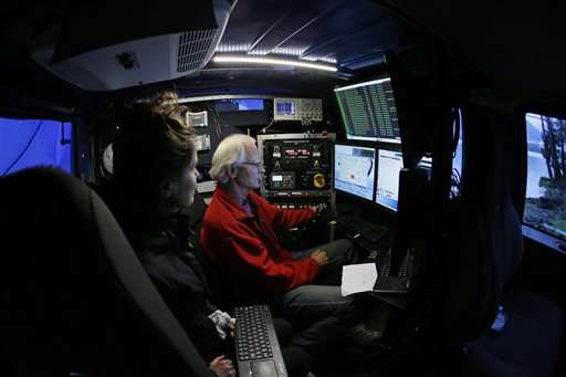
Radar Meteorologists Mike Dixon, right, and Karen Kosiba, left, view data screens as they work in a truck-mounted radar instrument called the Doppler On Wheels, Friday, Nov. 6, 2015, on the banks of Lake Quinault near Amanda Park, Wash. Led by NASA and hosted by the University of Washington, a team of meteorologists and scientists is fanning out across one of the wettest places in the country in November to measure raindrops and snowdrops and attempt to validate, on the ground, how well global satellites measure precipitation from space. (AP Photo/Ted S. Warren) -
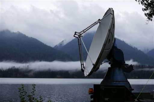
A truck-mounted radar instrument called the Doppler On Wheels scans cloudy skies Friday, Nov. 6, 2015, on the banks of Lake Quinault near Amanda Park, Wash. Led by NASA and hosted by the University of Washington, a team of meteorologists and scientists is fanning out across one of the wettest places in the country in November to measure raindrops and snowdrops and attempt to validate, on the ground, how well global satellites measure precipitation from space. (AP Photo/Ted S. Warren) -
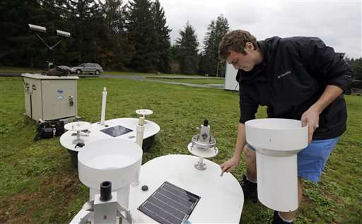
Brandon Jameson, a ground validation engineer, adjusts a rain gauge located at the Quinault National Fish Hatchery, near Humptulips, Wash., Friday, Nov. 6, 2015. Led by NASA and hosted by the University of Washington, a team of meteorologists and scientists is fanning out across one of the wettest places in the country in November to measure raindrops and snowdrops and attempt to validate, on the ground, how well global satellites measure precipitation from space. (AP Photo/Ted S. Warren) -
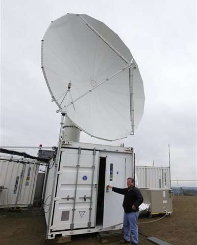
David Wolff, a research scientist with NASA, opens the door to a mobile workspace, Friday, Nov. 6, 2015, below one of the large radar instruments installed on a hilltop near Moclips, Wash. Led by NASA and hosted by the University of Washington, a team of meteorologists and scientists is fanning out across one of the wettest places in the country in November to measure raindrops and snowdrops and attempt to validate, on the ground, how well global satellites measure precipitation from space. (AP Photo/Ted S. Warren) -
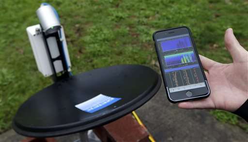
Research scientist Matt Wingo views live radar precipitation data on his mobile phone as he monitors a radar dish located at the Quinault National Fish Hatchery in near Humptulips, Wash., Friday, Nov. 6, 2015. Led by NASA and hosted by the University of Washington, a team of meteorologists and scientists is fanning out across one of the wettest places in the country in November to measure raindrops and snowdrops and attempt to validate, on the ground, how well global satellites measure precipitation from space. (AP Photo/Ted S. Warren) -
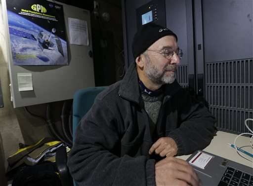
NASA scientist Mathew Schwaller works on a computer Friday, Nov. 6, 2015, near Moclips, Wash. Schwaller is the manager of a project led by NASA and hosted by the University of Washington that will measure raindrops and snowdrops and attempt to validate, on the ground, how well global satellites measure precipitation from space. (AP Photo/Ted S. Warren)
© 2015 The Associated Press. All rights reserved.


