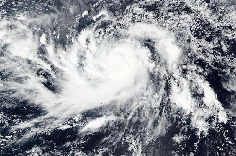
NASA sees In-Fa get better organized, re-strengthen

When the Global Precipitation Measurement Mission of GPM core satellite analyzed Tropical Storm In-fa, data showed the storm had become better organized over the previous 24 hours. After GPM, NASA-NOAA's Suomi NPP satellite provided a visible image that confirmed a better-organized storm.
On Nov. 20, a tropical storm warning remains in effect for Guam. A high surf warning and advisory is in effect for the northern Marianas for hazardous surf along the north and east-facing reefs. At 12:25 a.m. CHST local time, Saturday, Nov. 21 2015, a high wind advisory is now in effect Guam International Airport until 6 a.m. CHST.
GPM is a satellite co-managed by NASA and the Japan Aerospace Exploration Agency. The GPM core observatory satellite had another excellent view of Typhoon In-fa on Nov. 19, 2015 at 0305 UTC (Nov. 18 at 10:05 p.m. EST). That GPM pass revealed the location of typhoon In-fa's eye beneath dense overcast. Rainfall derived from data collected by GPM's Microwave Imager (GMI) and Dual-Frequency Precipitation Radar (DPR) instruments showed that feeder bands (of thunderstorms) around In-fa were getting better organized. The most intense precipitation was measured in In-fa's eye wall by DPR where it was falling at a rate of almost 55 mm (2.16 inches) per hour. GPM saw that most rainfall in feeder bands were only light to moderate.

At NASA's Goddard Space Flight Center in Greenbelt, Maryland, a 3-D view of the typhoon was created. The 3-D view of In-fa's cloud tops was constructed using GPM radar data (Ku band) whose swath crossed through the center of the storm. A few towering storms in In-fa's eye wall were reaching heights of up to 17.3 km (10.7 miles).
NASA-NOAA's Suomi NPP satellite captured a visible image of In-fa on Nov. 20 at 03:15 UTC and it showed more organized bands of thunderstorms wrapping into the center.
At 1200 UTC (7 a.m. EST/10 p.m. CHST Guam local time) the center of Typhoon In-fa was located by radar near latitude 10.8 degrees north and longitude 145.6 degrees east. In-fa was 190 miles east-southeast of Guam. In-fa was moving west at 18 mph and is expected to turn back to the west-northwest. This motion and track keeps in-fa south of Guam as it passes by Saturday morning, Nov. 21.
Maximum sustained winds remain at 115 mph. Typhoon force winds extend outward up to 35 miles from the center. Tropical storm force winds extend outward up to 140 miles north of the center...and up to 120 miles south of the center. In-fa is expected to intensify through the weekend.
For the latest forecasts, watches and warnings, visit NOAA's Guam National Weather Service Office website: http://www.prh.noaa.gov/guam/.
Provided by NASA's Goddard Space Flight Center


