NASA tracks Hurricane Patricia's remnants through Gulf states

As the remnants of Hurricane Patricia continue to generate flooding rainfall as it moved through the Gulf Coast states on October 26, NASA and NOAA satellites provided data on the storm.
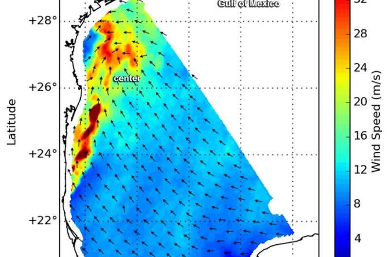
RapidScat gathered wind speed and direction data on the remnants of Hurricane Patricia on Oct. 24 at 9 p.m. EDT. RapidScat is an instrument that flies aboard the International Space Station and measures surface winds over open waters of oceans. RapidScat showed that the strongest sustained winds were near 36 meters per second/70 knots/80.5 mph/129.6 kph north and west of the center, which RapidScat showed over the western Gulf of Mexico." RapidScat caught a view of the Gulf of Mexico where gulf wind speeds are very high just adjacent to the flooding in Texas," said Doug Tyler of the RapidScat team at NASA's Jet Propulsion Laboratory in Pasadena, California.
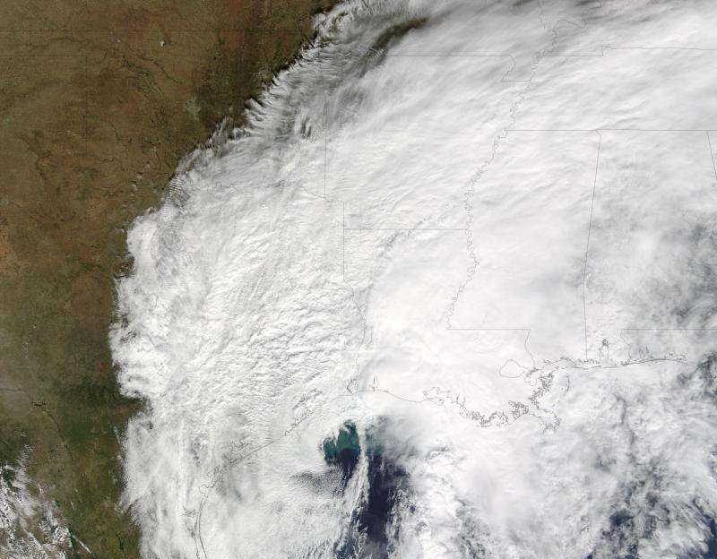
On Oct. 25 at 17:15 UTC (1:15 p.m. EDT) the Moderate Resolution Imaging Spectroradiometer that flies aboard NASA's Terra satellite saw the remnants of Hurricane Patricia over Texas, Louisiana and Mississippi. The visible image showed the center over the northwestern Gulf of Mexico and powerful thunderstorms over the Gulf States. The image was created by the NASA MODIS Rapid Response Team at NASA's Goddard Space Flight Center in Greenbelt Maryland.
A 21 second animation of infrared and visible imagery from NOAA's GOES-East satellite over the period of Oct. 24 to 26 showed the remnants of Hurricane Patricia wrapped into a low pressure area move through the Gulf of Mexico and Gulf Coast States. On October 24, strong thunderstorms were seen developing over the Texas east coast and then over eastern Texas, Louisiana and Mississippi as it moved into the Mississippi Valley. The animation was created by the NASA/NOAA GOES Project at NASA Goddard.

NOAA's National Weather Service said on October 26, that "the system that brought heavy rainfall and flash flooding to parts of the southern Plains and western Gulf Coast over the past several days continues to push eastward, with the greatest potential for heavy rain and flash flooding on Monday across parts of the lower Mississippi Valley and Southeast. There is also a Marginal Risk for severe thunderstorms across the region."
For updated forecasts, visit the National Weather Service website at: http://www.weather.gov.
Provided by NASA's Goddard Space Flight Center


