Tropical Depression Marty finally moving away from Mexico coastline

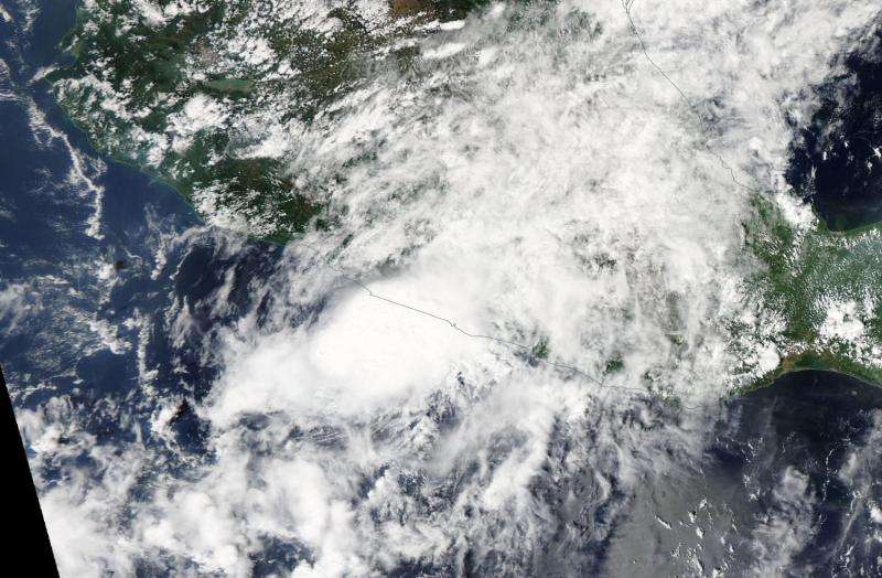
Tropical Depression Marty has been an unwelcome visitor along the western coast of Mexico for a couple of days and is finally, but slowly leaving. NASA's Aqua satellite saw the northeastern quadrant of the storm over the Mexican coast yesterday, September 29.
NASA's Aqua satellite passed over Tropical Depression Marty on Sept. 29 and the Moderate Resolution Imaging Spectroradiometer or MODIS instrument took a visible picture of the storm. The image showed the northeastern quadrant still over southwestern Mexico's coast while the center of the storm remained over the Eastern Pacific Ocean. Despite weakening, Marty still maintained a circular appearance.
Since Marty was still near the coast on September 30, that meant heavy rain and ocean swells continued. The National Hurricane Center (NHC) noted that Marty is expected to produce rainfall amounts of 3 to 6 inches over the Mexican state of Guerrero through Thursday, October 1. Isolated amounts of 10 inches are possible are possible in Guerrero from the Sierra Madre del Sur mountains toward the coast. These rains are expected to produce life-threatening flash floods and mud slides, especially in areas of mountainous terrain.
Swells generated by Marty are still affecting portions of the coast of southern Mexico. These swells will soon begin to subside, but are still likely to cause life-threatening surf and rip current conditions.
At 11 a.m. EDT (1500 UTC), the center of Tropical Depression Marty was located near latitude 16.2 North, longitude 102.6 West. The depression was moving toward the west near 6 mph (9 kph) and the NHC expects this general motion to continue over the next two days. Maximum sustained winds were near 35 mph (55 kph) but the depression is expected to degenerate into a remnant low by Thursday, October 1.

For updated forecasts, visit the National Hurricane Center website: http://www.nhc.noaa.gov.
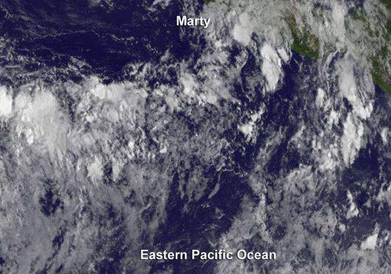
In an image from NOAA's GOES-East satellite on September 30 at 1500 UTC (11 a.m. EDT), Marty's small low-level circulation showed a slight burst of deep convection (developing thunderstorms) along the northern side of the center.
Marty was being battered by southwesterly vertical wind shear as strong as 20 knots that is expected to continue over the next few days.
Provided by NASA's Goddard Space Flight Center


