NASA sees Tropical Storm Kilo affected by wind shear

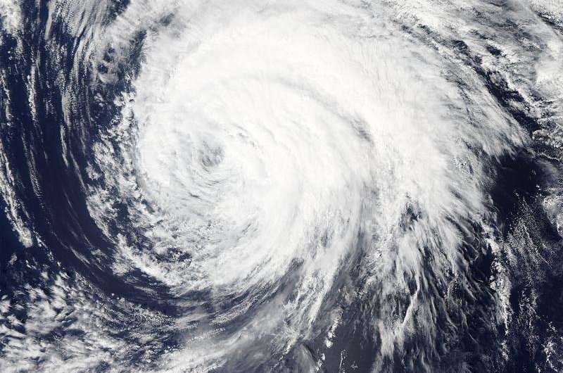
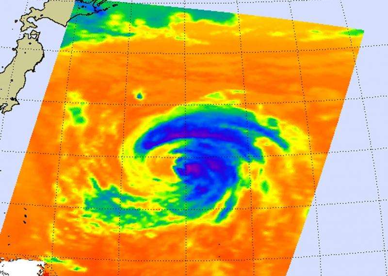
Strong vertical wind shear is taking its toll on the now weaker Tropical Storm Kilo in the Northwestern Pacific Ocean. Visible and infrared imagery from NASA's Aqua satellite shows that southwesterly wind shear has been pushing the clouds and storms to the northeast of the storm's center.
The Atmospheric Infrared Sounder or AIRS instrument that flies aboard NASA's Aqua satellite gathers infrared data that reveals temperatures. When NASA's Aqua satellite passed over Tropical Storm Kilo on September 9 at 1547 UTC (11:47 a.m. EDT), the AIRS data and showed some highest, coldest, strongest thunderstorms with cloud top temperatures near -63F/-53C were being pushed north and east of the center as a result of strong vertical wind shear.
On September 10, the Joint Typhoon Warning Center noted that animated enhanced infrared satellite imagery continues to indicate eroding deep convection displaced over the northern semi-circle of the system.
When NASA's Aqua satellite passed over Kilo again on September 10 at 02:50 UTC (Sept. 19 at 10:50 p.m. EDT), the Moderate Resolution Imaging Spectroradiometer or MODIS instrument took a visible picture of the storm. The MODIS image showed that strong wind shear continued to push the clouds northeast of the center.
At 11 a.m. EDT (1500 UTC) the center of Tropical Storm Kilo was located near latitude 35.9 north and longitude 148.4 west. About 483 nautical miles (555.8 miles/894.5 km) southeast of Misawa Air Base, Japan. Kilo was moving toward the north-northwest near 13 knots (14.9 mph/24 kph) and is expected to turn toward the west-southwest on Sept. 9 and 10. Maximum sustained winds are near 50 knots (57.5 mph/ 92.6 kph).

Kilo was moving north-northwest and continues to weaken. Kilo is expected to become extra-tropical on September 11 off Hokkaido, Japan, the northernmost of Japan's main islands.
Provided by NASA's Goddard Space Flight Center


