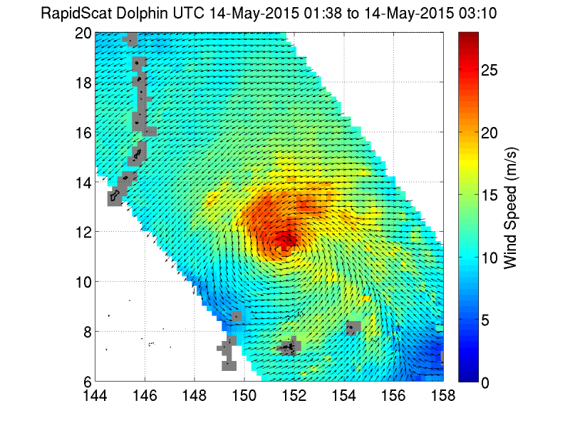
Typhoon Dolphin closing in on Guam

A tight, highly developed and organized Typhoon Dolphin is closing in on Guam as it cruises across the Pacific at 16 knots. It is currently located 290 miles east southeast of Andersen AFB located in Guam. The RapidScat image taken on May 14, 2015 shows a very tight spiral of winds in the center which shows a very organized storm eye. Winds at present are at 95 knots gusting to 115 (109 - 132 mph).
Dolphin is expected to slide by Guam on Friday afternoon, possibly crossing over the island of Rota. At the time of landfall forecasters are predicting its strength will be equal to a Category 3 hurricane, and possibly a Category 4. Guam and the Norther Mariana Islands should be on alert for high winds, torrential rains, and damaging surf. Wave heights at present are 32 feet.
The track of the storm has it skirting Guam, but tracking across Rota, however, the storm's track could change. Regardless of its exact track, Dolphin will bring dangerous conditions to Guam as well as the islands of Rota, Aguijan, Tinian and Saipan. All these islands can expect damaging winds and torrential rainfall. Residents should continue to monitor the storm carefully.
Provided by NASA's Goddard Space Flight Center


