Topography a blueprint for wildlife conservation

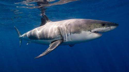
A study of predator hotspots has found that rugged landscapes attract predators, both at sea and on land.
Study co-author Phil Bouchet (UWA) and his team reviewed more than 30 years of published ecological research and found the role of topography in shaping wildlife distributions and behaviour had been inadequately reported.
"One point of the paper was to review the literature to see what we knew about predators in general and where they group together," Mr Bouchet says.
"The second aim of the article was to further understand how people have tried to capture that in a mathematical manner and determine if those measures are appropriate or not."
The authors argue that dozens of mathematical tools are now available to determine just how rugged natural terrains are, but very few have been adopted in ecological models.
"We found a huge bias towards mean depth and mean elevation," Mr Bouchet says.
Mean depth is the average deepness of an area while mean elevation refers to the average height of an area or terrain.
Within the paper there are 3D representations of different parts of the WA seafloor with similar mean depths but vastly different topographic shapes.
"Our figure shows some locations which have virtually the same mean depth but are worlds apart in terms of their underlying topography," Mr Bouchet says.
"Some are really smooth and have a gentle slope whereas others are really complex with lots of ridge lines and peaks."
This leads the authors to believe that by involving greater and more specific variables such as rugosity and fractal dimension, the complexity of an entire area can be mapped out.
Digital terrain modelling key to predator conservation
The team also conducted computer simulations to determine which topographic variables were most useful in characterising landscape complexity.
"We discovered that landscapes can be simplified to a small set of numerical characteristics that likely reflect important ecological processes," Mr Bouchet says.
"Terrain patterns could therefore be used to predict critical areas for predator species.
"By protecting predator hotspots not only can we make a difference in conserving predator species but we also have a chance of protecting a wider range of organisms."
More information: Bouchet, P. J., Meeuwig, J. J., Salgado Kent, C. P., Letessier, T. B. and Jenner, C. K. (2014), "Topographic determinants of mobile vertebrate predator hotspots: current knowledge and future directions." Biological Reviews. doi: 10.1111/brv.12130
Journal information: Biological Reviews
Provided by Science Network WA


