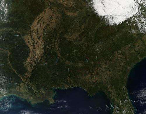
NASA image: Fires in the southern United States

In this image taken by the Aqua satellite of the southern United States actively burning areas as detected by MODIS's thermal bands are outlined in red. Each red hot spot is an area where the thermal detectors on the MODIS instrument recognized temperatures higher than background. When accompanied by plumes of smoke, as in this image, such hot spots are diagnostic for fire.
These fires are a combination of small wildfires and prescribed fires. On the U.S. Forest Service website a prescribed fire is set to reduce tree overcrowding, revive fire-dependent species and reduce flammable fuels. Per the U.S. Wildlife Service website:
"The right fire at the right place at the right time can help with all of the following:
- Reduces hazardous fuels, protecting human communities from extreme fires;
- Minimizes the spread of pest insects and disease;
- Removes unwanted species that threaten species native to an ecosystem;
- Provides forage for game;
- Improves habitat for threatened and endangered species;
- Recycles nutrients back to the soil; and
- Promotes the growth of trees, wildflowers, and other plants"
This natural-color satellite image was collected by the Moderate Resolution Imaging Spectroradiometer (MODIS) aboard the Aqua satellite on October 22, 2014. NASA image courtesy Jeff Schmaltz, MODIS Rapid Response Team. Caption: NASA/Goddard, Lynn Jenner
Provided by NASA's Goddard Space Flight Center


