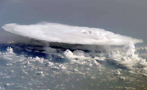
Merging cloud and precipitation radar data provides a better view of tropical rain clouds

Filling a gap in the picture of tropical clouds, a research team led by Pacific Northwest National Laboratory combined two views of clouds in the tropical Indian Ocean. Using collocated precipitation and cloud radar measurements, they developed a seamless dataset that represents the full spectrum of tropical clouds. This dataset holistically describes all cloud types in the tropics, including heavily precipitating clouds, permitting a clearer picture of their influence on the climate.
"Our ability to observe heavy rain clouds in the tropics has always been limited by the cloud radar system," said Dr. Zhe Feng, atmospheric scientist at PNNL. "We filled in the gaps by merging—for the first time—two sets of data into one for improved understanding of tropical clouds."
Whether it's a downpour in Dallas or a snow storm in St. Louis, most of the world's precipitation originates in the tropics. Tropical storm clouds have been called the engines of the climate, so scientists want to understand how they form and influence the complex physical phenomena that move water and heat through the atmosphere. Cloud and precipitation radar instruments installed and operated by the U.S. Department of Energy's Atmospheric Radiation Measurement (ARM) Climate Research Facility located in the tropics take continuous measurements of clouds. The research detailed in this paper plugged some gaps in the cloud data, providing a more complete view for future cloud research.
Observing heavily precipitating clouds, abundant in the tropics, has always been limited by the cloud radar measurement system, creating gaps when tropical storm clouds occur. Researchers from PNNL, Texas A&M and the National Center for Atmospheric Research compared collocated measurements obtained from a scanning precipitation radar and a vertically pointing cloud radar during ARM's ACRF Madden-Julian Oscillation Investigation Experiment (AMIE) field campaign. Their research characterized the strengths and weaknesses of both systems in detecting a variety of cloud types. When heavily precipitating clouds occur, the cloud radar signals are weakened and failed to penetrate to the cloud top. Precipitation radar profiles filled in the gaps, creating continuous profiles of both precipitating and non-precipitating clouds. The new dataset improves the representation of the retrieval of cloud microphysics and radiative heating rates in all sky conditions.
This data product (www.arm.gov/data/pi/71) has already been used in the research community to improve understanding of tropical convection, which is a major source of uncertainty in all climate models.
The new dataset is being used by scientists at PNNL and the scientific community to study the co-evolution of moisture and clouds in the tropics, which will improve fundamental understanding of tropical convective clouds and the climate system.
More information: Feng Z, SA McFarlane, C Schumacher, S Ellis, J Comstock, and N Bharadwaj. 2014. "Constructing a Merged Cloud-Precipitation Radar Dataset for Tropical Convective Clouds during the DYNAMO/AMIE Experiment at Addu Atoll." Journal of Atmospheric and Oceanic Technology, early online. DOI: 10.1175/JTECH-D-13-00132.1 . journals.ametsoc.org/doi/abs/1 … 5/JTECH-D-13-00132.1
Provided by Pacific Northwest National Laboratory


