Ontario lake-effect snows create 'Ideal laboratory' for meteorologists

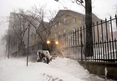
(Phys.org) —As a blizzard shut down much of northern New York State in early January, researchers from the University at Albany and SUNY Oswego took to the shores of Lake Ontario to peer into the innards of the storm.
In fact, along with colleagues from campuses as far-flung as Alabama and Utah, Justin Minder, assistant professor in UAlbany's Department of Atmospheric and Environmental Sciences, and Scott Steiger, associate professor of meteorology at Oswego, spent most of December and January in the field, studying the region's lake effect snow.
Their work was part of a project called OWLeS (Ontario Winter Lake-effect Systems), and their findings could help meteorologists predict more precisely where snow will fall, and how fast. "Lake effect snow is an ideal laboratory to study what we call boundary layer processes," says Steiger.
The boundary layer is the band of atmosphere affected by the ground or water below. A lake effect storm is fairly small, and it usually sits in one spot for hours, making it easier to study than phenomena such as tornadoes. "We can just stay around Lake Ontario and sample the storm," said Steiger.
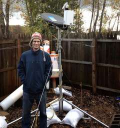
Another goal of OWLeS is to better understand the influence of topography. That is a major focus for Minder, whose UAlbany team deployed four Micro Rain Radar systems, starting at the lake and running onto the Tug Hill Plateau. The radars point straight up, capturing changes in the clouds' vertical structures as the storm crosses different terrain.

"We don't often capture very well how topography affects precipitation, because we usually don't have enough observations on the ground, or high enough resolutions from our computer models," Minder says. Understanding those effects could help meteorologists better predict which communities should gird for two feet of snow and which can expect just a few inches.
During one 24-hour period on Dec. 11, 2013, Minder's team were able to assess the effects of more than 40 inches of snowfall upon New York's Tug Hill plateau.
Steiger's team participates in OWLeS under a $320,000 grant from the National Science Foundation (NSF)—one of three grants, totaling $4 million, that NSF gave to the overall project. Minder participates in OWLeS with the support of a seed grant from UAlbany's Faculty Research Award Program.
Tools for sampling include a trailer loaded with instruments, from the University of Alabama-Huntsville, Doppler-on-Wheels (DOW) radar devices from the Center for Severe Weather Research in Boulder, Colo. and, courtesy of the University of Wyoming, a specially-instrumented aircraft called the King Air.
Other equipment used in OWLeS helps researchers distinguish snowflakes in the clouds from small ice pellets. "By doing that, we can better estimate how quickly the snow or ice is going to pile up on the ground," said Steiger. "That's useful information, for example, when dispatchers are sending out snow plows."
Provided by University at Albany


