World's largest coral reef mapped

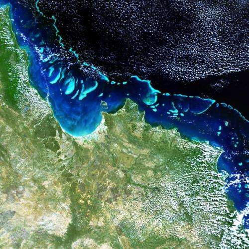
Scientists have used satellite observations to create a set of high-resolution 3D maps of the entire Great Barrier Reef – a critical step towards identifying, managing and protecting what lies beneath the waters.
Sitting off the east coast of Australia, the Great Barrier Reef is the world's largest coral reef system, covering more than 344 000 sq km. The reef's diversity of life faces numerous threats such as climate change, pollution, fishing and outbreaks of the coral-preying crown-of-thorns starfish.
While these coral reefs are ecologically significant, they have proven difficult to map from survey vessels or aircraft owing to their shallow nature and remoteness.
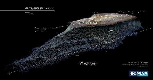
The German aquatic remote sensing company EOMAP has used satellites to overcome these hurdles. The result is the largest project of its kind ever conducted in Australia: a high-resolution, 3D map of the entire reef system.
To produce the map, the company combined satellite optical imagery with tide information and existing ocean floor topography data. High-resolution optical satellite data are best suited for clear water to depths of 20 m under calm weather conditions.
The map will aid 'big picture' assessments of the Great Barrier Reef. This includes water quality, measuring responses to man-made and natural effects, and helping to predict the likely impacts of climate change, such as rising sea levels and increasingly frequent tropical cyclone.

The map will also help target priority areas for collecting more detailed information. With the vast improvements this promises for modelling ocean currents, scientists can predict crown-of-thorns starfish larval paths to where they are next likely to inhabit the Reef.
EOMAP's development was supported by ESA's Business Incubation Centre in Bavaria, one of the nine centres set up by the Agency to support start-up companies in developing new business in Europe drawing on space technology and satellite services.
The company's satellite service for mapping global seafloor topography also won the T-Systems Cloud Computing Challenge in this year's Copernicus Masters competition. The competition seeks innovative solutions for business and society based on Earth observation data, while fostering creative product development and entrepreneurship in Europe.
All of the mapped areas, at a resolution of 30 m, are available for purchase through the company's website. A coarser product with 500 m resolution is also available free of charge, together with sample data of the high-resolution products.
EOMAP has already demonstrated the viability of the next-generation product: a map with 2 m resolution of the reef using DigitalGlobe's Worldview-2 satellite, and will use the capabilities of the upcoming Sentinel-2 satellites to generate maps of global seafloor topography.
Provided by European Space Agency


