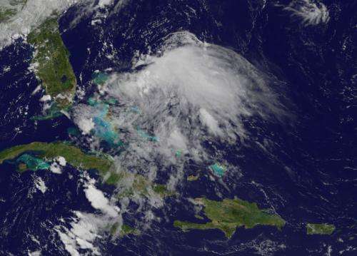
Satellite views Chantal's remnants over Bahamas

NOAA's GOES-13 satellite spotted the remnant clouds and showers from former Tropical Storm Chantal lingering over the Bahamas on July 12. Chantal's chances for regeneration are diminishing because of upper-level winds.
A visible image from NOAA's GOES-13 satellite at 9:45 a.m. EDT on July 12, 2013 showed Chantal's remnant clouds and showers moving north in the Atlantic. The image of Chantal's remnants resembled the sideways view of a jellyfish. The GOES image was created by NASA's GOES Project at the NASA Goddard Space Flight Center, Greenbelt, Md.
The National Hurricane Center (NHC) noted that the remnants remain disorganized, and that development has become less likely. Upper-level winds helped cause the demise of the tropical cyclone and continue to affect the storm. On July 13 at 8 a.m. EDT, the NHC gave Chantal's remnants a 10 percent change of regenerating into a tropical cyclone during the next 48 hours. In fact, the NHC even canceled the Air Force reconnaissance mission scheduled for July 13.
Provided by NASA's Goddard Space Flight Center


