NASA satellite sees Dalila become a hurricane in Eastern Pacific

The tropical storm that has been hugging the southwestern coast of Mexico moved toward open ocean and strengthened into a hurricane on July 2. NASA's Aqua satellite passed over Dalila after moving away from the coast and strengthening into a hurricane. Dalila has become the third hurricane of the Eastern Pacific Ocean hurricane season after Barbara and Cosme. As Dalila starts to weaken, a new tropical low appears to be developing to the southeast.
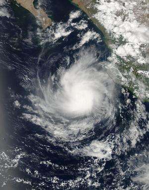
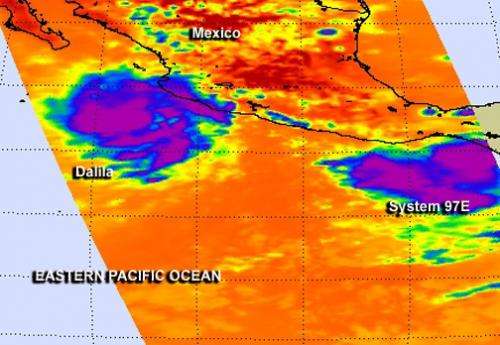
On July 2 at 20:55 UTC (4:55 p.m. EDT) flew over Dalila after the storm became a hurricane. The Moderate Resolution Imaging Spectroradiometer (MODIS) instrument aboard Aqua took a visible image of Dalila west of the Mexican state of Jalisco. The MODIS image showed strong thunderstorms around the center of circulation and bands of thunderstorms streaming into the center from the northern and southern quadrants. Infrared data from NASA's Atmospheric Infrared Sounder or AIRS instrument that also flies aboard Aqua showed that cloud top temperatures are as cold as -80 Celsius or -112 Fahrenheit.
At 5 a.m. EDT (0900 UTC) on July 3, Dalila had maximum sustained winds near 75 mph (120 kph) making it a Category 1 hurricane. Dalila's center was near latitude 18.1 north and longitude 107.5 west, about 220 miles (350 km) west-southwest of Manzanillo, Mexico. Dalila is moving toward the southwest near 2 mph (4 kph) and the National Hurricane Center expects a slow west-southwestward or southwestward motion over the next day or two, then a turn to the west on July 4, after which time the storm is expected to weaken. The estimated minimum central pressure is 987 millibars.
Although the storm is off the coast of Mexico, coastal areas can expect very rough surf for the next couple of days as the storm continues moving westward. The National Hurricane Center noted that swells generated by Dalila are affecting portions of the southwestern coast of Mexico from near Zihuatanejo to Cabo Corrientes. These swells could cause life-threatening surf and rip current conditions.

Meanwhile, southwest of Dalila, the broad low pressure area called System 97E continues developing several hundred miles south of the Gulf of Tehuantepec. According to NHC, environmental conditions are expected to gradually become more conducive for development over the next couple of days, so System 97E has a medium chance...50 percent...of becoming a tropical cyclone in the next two days as it moves in a westerly direction at about 10 mph.
Provided by NASA's Goddard Space Flight Center


