Cyclone Haruna makes landfall in Madagascar

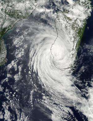
NASA's Aqua satellite passed over Cyclone Haruna after it made landfall in southwestern Madagascar.
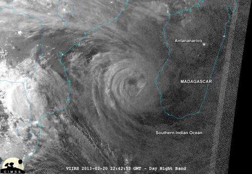
Haruna's center made landfall near Manombo, Madagascar around 0600 UTC (1 a.m. EST/U.S.) The METEO-7 satellite captured a visible image of Haruna at the time of landfall and showed that its eye had already become cloud-filled.
The Moderate Resolution Imaging Spectroradiometer (MODIS) instrument aboard NASA's Aqua satellite captured a visible image of Tropical Storm Haruna on Feb. 22 at 1105 UTC (6:05 a.m. EST) after it moved inland and its eye was completed cloud-filled. MODIS imagery revealed that the size of the eye was smaller since the storm made landfall.
As a result of its interaction with land, Haruna's maximum sustained winds dropped to 80 knots by 1200 UTC (7 a.m. EST) on Feb. 22. Haruna's cloud-filled eye was centered near 23.3 south latitude and 44.2 east longitude, about 300 nautical miles southwest of Antananarivo, the capital and largest city in Madagascar. Haruna was moving to the south-southeast at 7 knots and dropping heavy rainfall along its path.
Radar at 10:30 a.m. EST (15:30 UTC) showed that Haruna's rainfall extends from the town of Belo Tsiribihina on Madagascar's west-central coast, east to the city of Fianarantsoa, and to the town of Taolagnaro on the southeastern coast.

Forecasters at the Joint Typhoon Warning Center (JTWC) noted that as Haruna keeps moving over land, the effects of friction (the storm dragging over the land) will continue weakening the circulation.
Once Haruna moves back into the waters of the Southern Indian Ocean it will encounter cooler waters than helped fuel it in the Mozambique Channel. Haruna will also experience increasing wind shear from mid-latitude westerly winds that will weaken the storm further. The JTWC expects Haruna to weaken to a remnant low pressure area by sometime on Feb. 25 over the Southern Indian Ocean.
Provided by NASA's Goddard Space Flight Center


