NASA saw Tropical Storm Murjan making landfall on the Horn of Africa

NASA's Aqua satellite watched from space as Somalia in the Horn of Africa experienced a landfalling tropical cyclone on Oct. 25.
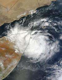
On Oct. 25, NASA's Aqua satellite saw Tropical Storm Murjan begin to make landfall in eastern Somalia, just south of Cape Guardafui. Cape Guardafui is located in the northeastern Bari province and forms the geographical point of the Horn of Africa.

On Oct. 25, 2012 at 0720 UTC (3:20 a.m. EDT) the Moderate Resolution Imaging Spectroradiometer (MODIS) instrument that flies aboard NASA's Aqua satellite captured a visible image of Tropical Storm Murjan's western half making landfall on the Horn of Africa while the eastern half of the storm was still over the Arabian Sea.
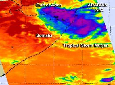
NASA's Aqua satellite also captured an infrared look at Tropical Storm Murjan as the storm continued moving inland. The Atmospheric Infrared Sounder (AIRS) instrument aboard captured infrared imagery that showed about one-half of the tropical storm had moved over Cape Guardafui, Somalia. The western half of the storm over land, contained some thunderstorms that were reaching high into the troposphere where cloud top temperatures were as cold as -63 Fahrenheit (-52 Celsius) and they have the potential to drop heavy rainfall.
As Murjan progressed on its western track, it continued to push further over the Horn of Africa, specifically in northeastern Somalia.
On Oct. 25 at 1500 UTC (11 a.m. EDT), Murjan had maximum sustained winds near 35 knots (40.2 mph/64.8 kph). It was located about 140 nautical miles east-southeast of Cape Guardafui, Somalia, near 9.4 North latitude and 50.7 East longitude. Murjan was moving to the west-southwest at 12 knots (13.8 mph/22.2 kph).
As Murjan continues to move over land, convection (rising air that forms thunderstorms that make up the tropical cyclone) continues to deteriorate quickly. Forecasters at the Joint Typhoon Warning Center expect Murjan to dissipate over land on Oct. 26.
Provided by NASA's Goddard Space Flight Center


