NASA radar to study volcanoes in Alaska, Japan

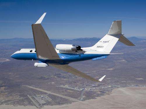
(Phys.org)—A NASA aircraft carrying a unique 3-D aerial radar developed by NASA's Jet Propulsion Laboratory, Pasadena, Calif., has left California for a 10-day campaign to study active volcanoes in Alaska and Japan.
The modified NASA C-20A (G-III) aircraft, with JPL's Uninhabited Aerial Vehicle Synthetic Aperture Radar (UAVSAR) installed in a pod under its belly, departed NASA's Dryden Aircraft Operations Facility in Palmdale, Calif., Oct. 2, en route to Joint Base Lewis-McChord in Tacoma, Wash. Along the way, it will image volcanoes in the western United States. After refueling, the aircraft will travel on to Joint Base Elmendorf-Richardson near Anchorage, Alaska, where UAVSAR will image a series of volcanoes, including those in the Aleutian Islands.
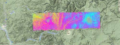
UAVSAR can see below Earth's surface to monitor very subtle deformations. NASA scientists periodically use UAVSAR to monitor subtle changes in volcanic activity. The radar uses a technique called interferometry, which sends pulses of microwave energy from the sensor on the aircraft to the ground to detect and measure very subtle Earth surface deformations.

The plane will then fly to Japan's Yokota Air Force Base near Tokyo. Yokota is the staging location for science missions to collect data about volcanoes on several islands in Japan that pose a hazard to nearby populations. On its return, the aircraft will repeat the route, acquiring data from the opposite viewing direction, before arriving back at its base in Palmdale Oct. 11.
This study builds on UAVSAR research of U.S. West Coast and Hawaiian volcanoes acquired from 2009 through 2011 and additional observations of Central and South American volcanoes gathered in 2010 and 2011.
The aircraft features a high-precision autopilot designed and developed by engineers at NASA's Dryden Flight Research Center. The Precision Platform Autopilot guides the aircraft using a kinematic differential Global Positioning System developed by JPL along with the aircraft's inertial navigation system to enable it to fly repeat paths to an accuracy of 15 feet (4.6 meters) or less. With the precision autopilot engaged, the synthetic aperture radar is able to acquire repeat-pass data that can measure land-surface changes within millimeters.
UAVSAR provides a measurement system that complements satellite-based observations by providing rapid revisits and imaging of active volcanoes to better understand their deformation prior to, during or after an eruption.
In addition to the NASA study of volcanoes, the UAVSAR team is working with Japan Aerospace Exploration Agency scientists to define cross-calibration sites, including flight lines over disaster and forested areas, between the UAVSAR and the Japan Aerospace Exploration Agency's Polarimetric and Interferometry Synthetic Aperture Radar with L-band 2 (PISAR-L2).
More information: For more on UAVSAR, visit: uavsar.jpl.nasa.gov/index.html .
Provided by JPL/NASA


