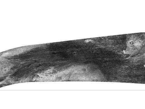
Putting it all together on Titan

Three of Titan's major surface features -- dunes, craters and the enigmatic Xanadu -- appear in this radar image from NASA's Cassini spacecraft. The hazy, bright area at the left that extends to the lower center of the image marks the northwest edge of Xanadu, a continent-sized feature centered near the moon's equator. At upper right is the crater Ksa, first seen by Cassini in 2006. The dark lines running between these two features are linear dunes, similar to sand dunes on Earth in Egypt and Namibia.
The image was taken by Cassini's Titan Radar Mapper on June 21, 2011.
The Cassini-Huygens mission is a cooperative project of NASA, the European Space Agency and the Italian Space Agency. NASA's Jet Propulsion Laboratory, a division of the California Institute of Technology in Pasadena, manages the mission for NASA's Science Mission Directorate, Washington, D.C. The Cassini orbiter was designed, developed and assembled at JPL. The radar instrument was built by JPL and the Italian Space Agency, working with team members from the United States and several European countries.
Provided by JPL/NASA


