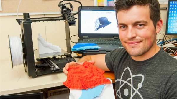
3-D printer churns out handheld underground water model

Cutting-edge three dimensional printing technology has produced a plastic model representing the land surface and underground water systems across 3.5 million hectares of the La Grange groundwater allocation area, south of Broome.
The model transforms masses of complex data into a hand-held representation to enable pastoralists and traditional owners to better understand the make-up of the region's land surface and underground water.
The 3D model shows the relationship between surface topography and the underground freshwater aquifer, saltwater and siltstone (rock consisting of consolidated silt).
Department of Agriculture and Food (DAFWA) research officer Nick Wright combined his hobby of 3D printing with his work in the department to produce the plastic model.
"It's such great fun," Mr Wright says.
"You put all this 3D modelling information into a computer, press a button, leave it overnight and come back and it's real.
"It's pretty mind blowing."
For this project, Mr Wright created a representation of the land surface using data from the NASA shuttle radar topography mission, which is freely available on the internet.
Shuttle data and aerial surveys add to model
He combined the NASA data with DAFWA ground water monitoring bore data to reveal the underground freshwater aquifer, and other data from a DAFWA aerial electromagnetic survey.
The data showed the underlying layer of impenetrable Jarlemai Siltstone and saltwater interface which penetrates underground for about 10km inland, affecting the saline content of groundwater along the coast.
After feeding the data into his computer, Mr Wright used the department's $2000 3D printer to print out the model at a cost of about $40.
The small printer uses a fine strand of plastic to print layer-upon-layer to build the model over a period of hours.
Mr Wright says the model helped pastoralists and traditional owners to better understand the department's research.
"Straight away they could see what we're dealing with, as the model provided a nice, visual way to explain the irrigation opportunities and constraints of the area," he says.
While Mr Wright relied on years of data collection to produce the layered model, he says landowners in other areas could produce simple topographical models of their properties with a 3D printer and free online data.
Provided by Science Network WA


