NASA sees tropical storm Blanca weaken

NASA's RapidScat instrument and NASA's Terra and Aqua satellites showed the transition of Blanca from a hurricane to a tropical storm before it made landfall in Baja California, Mexico. June 8, Blanca was affecting Baja California and a tropical storm warning remained in effect from La Paz to Loreto and Santa Fe to Punta Abreojos. In addition, a tropical storm watch was in effect from north of Loreto to Mulege.
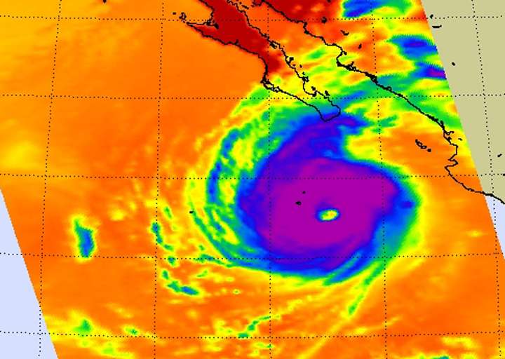
On June 6 at 20:53 UTC (4:53 p.m. EDT), NASA's AIRS instrument infrared data showed an impressive eye in Hurricane Blanca with strong storms circling the eye. At that time, Blanca was still a hurricane with maximum sustained winds near 120 mph (195 kph). Thunderstorms reached high into the troposphere and cloud tops had temperatures as cold as minus 63 degrees Farenheit / minus 52 degrees Celcius. Research has shown storms with cloud tops that cold (and high) have the potential for dropping heavy rainfall.
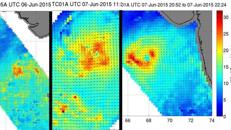
The International Space Station (ISS)-RapidScat instrument measures surface winds over the ocean. The ISS-RapidScat instrument gathered surface wind data from Blanca on June 6 from 5:24 to 9:56 p.m. EDT and again on June 7 from 7:57 to 9:30 p.m. EDT. On June 6, RapidScat identified hurricane-force winds around the eye of the storm. By June 7, those winds were limited to the eastern quadrant of the storm as it approached landfall on the southern tip of Baja California.
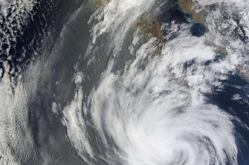
Also on June 7, the MODIS instrument aboard NASA's Terra satellite captured a picture of the weakening Tropical Storm Blanca at 18:30 UTC (2:30 p.m. EDT). The image showed Blanca's eye had disappeared and bands of thunderstorms still spiraled into the center from all quadrants.
At 11 a.m. EDT the center of tropical storm Blanca was located near latitude 25.1 north, longitude 112.0 west. Maximum sustained winds have decreased to near 40 mph (65 kph).

The National Hurricane Center (NHC) cited an unofficial weather station at Loreto, on the east coast of Baja California Sur, had recently reported a wind gust to 46 mph (74 kph).
The NHC said that Blanca was moving toward the north-northwest near 15 mph (24 kph), and this general motion is expected to continue through Tuesday. On the forecast track the center of Blanca will move near or over portions of the southern and central Baja California peninsula today through Tuesday.
Additional weakening is forecast during the next day or so, and Blanca is expected to degenerate into a remnant low by Tuesday, June 9. For local effects and updated forecasts, visit the NHC at http://www.nhc.noaa.gov.

Provided by NASA's Goddard Space Flight Center


