NASA sees Tropical Cyclone Joalane's strongest southwestern side

Tropical Cyclone Joalane had already become an extra-tropical system on April 13 fading over the Southern Indian Ocean. In the days before, two NASA instruments in space provided a look at the weakening storm.
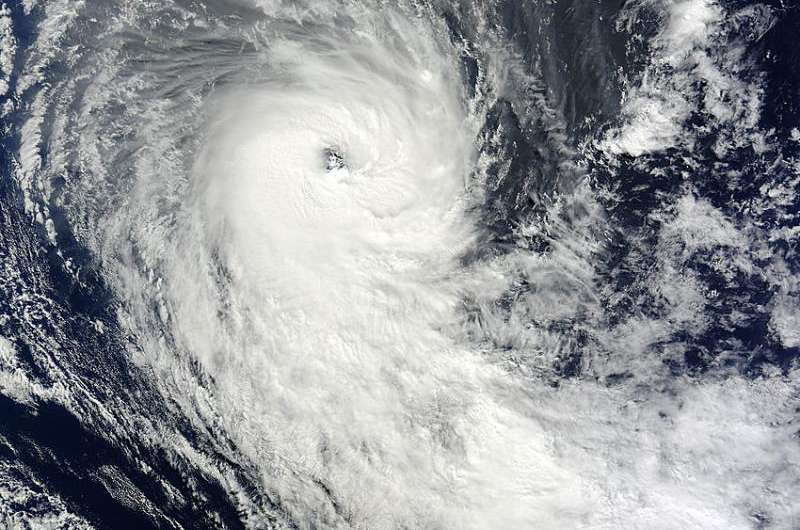
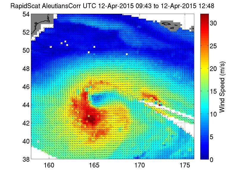
Tropical Cyclone Joalane's strongest side was southwest of its center, according to surface wind data from the RapidScat instrument that flies aboard the International Space Station (ISS). The day before RapidScat measured the tropical cyclone's winds, NASA's Terra satellite captured a visible-light image of the entire storm.
On April 11 at 5:40 UTC (1:40 a.m. EDT) the MODIS instrument aboard NASA's Terra satellite captured a visible-light image of Tropical Cyclone Joalane that showed an eye, open wide and the bulk of clouds and thunderstorms southwest of the center. That didn't change much the next day when the ISS-RapidScat instrument looked at the sustained winds in the hurricane-force storm.
RapidScat measured the surface winds within Tropical Cyclone Joalane late on April 12 from 9:43 to 12:48, revealing that the strongest winds were as high as 30 meters per second (67.1 mph/108 kph) in the southwestern quadrant of the storm. The data was generated into images at NASA's Jet Propulsion Laboratory in Pasadena, California.
The Joint Typhoon Warning Center (JTWC) issued their final bulletin on Joalane on April 12, 2015 when maximum sustained winds dropped to 55 knots (63.2 mph/101.9 kph). Joalane was moving to the south-southwest at 13 knots (14.9 mph/24.0 kph) and transitioning into an extra-tropical storm. At the time, it was 668 nautical miles east-southeast of Port Louis, Mauritius near 25.8 south latitude and 67.7 east longitude.
On April 13, extra-tropical storm Joalane continued to move into an area of cooler sea surface temperatures and increased vertical wind shear and has passed into tropical cyclone history.

Provided by NASA's Goddard Space Flight Center


