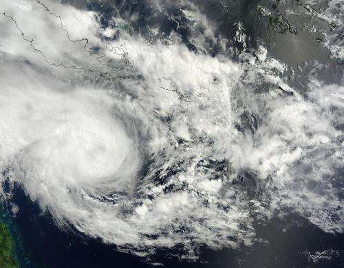
NASA sees Tropical Cyclone Nathan moving south and strengthening

The MODIS instrument aboard NASA's Terra satellite captured a visible image of Tropical Cyclone Nathan east of the Queensland coast on March 16 at 0:00 UTC. The image showed a rounded circulation with bands of thunderstorms wrapping into the center of circulation.
At 0900 UTC (5 a.m. EDT), Tropical cyclone Nathan's maximum sustained winds were near 55 knots (63.2 mph/102 kph) and the storm was consolidating and organizing. The Joint Typhoon Warning Center (JTWC) forecasters expect Nathan to strengthen to 70 knots in two days.
Nathan was centered near 14.3 south latitude and 150.2 east longitude, about 298 nautical miles east-northeast of Cairns, Australia. It was moving to the southeast at 5 knots (5.7 mph/9.2 kph).
JTWC noted satellite imagery revealed "a slowly-consolidating low-level circulation center slightly to the east of the deepening convection."
Nathan is moving southeast. The Joint Typhoon Warning center expects Nathan to strengthen to about 70 knots (80.5 mph/120.6 kph) in a couple of days before weakening again and turning back to the west toward Queensland.
Provided by NASA's Goddard Space Flight Center


