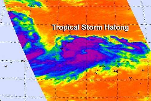
NASA sees developing Tropical Storm Halong causing warning

NASA infrared satellite data revealed that Tropical Storm Halong is surrounded by strong thunderstorms and an eye appears to be developing.
When NASA's Aqua satellite passed over Tropical Storm Halong on July 29 at 03:29 UTC (July 28 at 11:29 p.m. EDT) the Atmospheric Infrared Sounder instrument captured data on the cloud cover. The infrared data showed very cold, high thunderstorm cloud top temperatures of powerful storms surrounding the center, with what appears to be an eye developing. Microwave satellite data also shows a small eye, with tightly-curved bands of thunderstorms wrapping into it.
A warning is in force for Rota and a Tropical Storm Watch is in effect for Guam, while a typhoon watch is also in effect got Guam.
On July 29 at 1500 UTC (11 a.m. EDT), Tropical Storm Halong's maximum sustained winds were near 55 knots (63.2 mph/101.9 kph). Halong was centered near 13.7 north latitude, approximately 134 nautical miles (154 miles/248 km) east of Andersen Air Force Base. Halong has tracked northwestward at 11 knots (12.6 mph/20.3 kph).
The Joint Typhoon Warning Center forecast indicates that Halong will move to the west-northwest through the Marianas Islands while continuing to intensify.
Provided by NASA's Goddard Space Flight Center


