NASA provides double vision on Typhoon Matmo

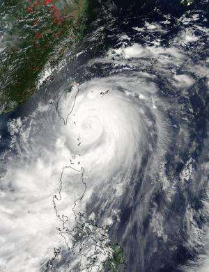
Two instruments aboard NASA's Aqua satellite provided different views of Typhoon Matmo on its approach to Taiwan today, July 22.
The Moderate Resolution Imaging Spectroradiometer or MODIS instrument snapped a visible picture of Typhoon Matmo's clouds on July 22 at 1:10 a.m. EDT. The MODIS image showed a center obscured by clouds. Bands of thunderstorms wrapped tightly into the center of circulation, creating the signature comma shape of a mature tropical cyclone. At the time of the image, the center was southeast of the southeastern tip of Taiwan. The image also showed that the southernmost band of thunderstorms were affecting Luzon, in the northern Philippines.
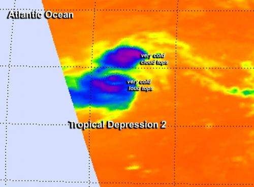
The second instrument aboard Aqua captured infrared data that showed temperatures of clouds. The Atmospheric Infrared Sounder or AIRS instrument gathered infrared data that was false-colored at NASA's Jet Propulsion Laboratory in Pasadena, California and made into an image. The AIRS image also did not show an open eye in Matmo, but did show powerful thunderstorms with very cold cloud top temperatures wrapped tightly around the center. Matmo's northwestern side was already over eastern Taiwan, while the southwestern quadrant blanketed the northern Philippines.
By 1500 UTC (11 a.m. EDT), the Joint Typhoon Warning Center noted that radar data from Taiwan showed the eye had become more visible as the storm was making landfall on the country's east coast. Maximum sustained winds were near 85 knots (97.8 mph/157.4 kph). Matmo was centered near 23.0 north latitude and 121.6 east longitude, about 158 nautical miles (181.8 miles/292.6 km) south of Taipei, Taiwan. Matmo was moving to the northwest at 9 knots (10.3 mph).

Matmo is generating 30-foot (9.1 meter) high seas which means rough seas and dangerous swells for the east coast of Taiwan in addition to typhoon-force winds, heavy rainfall and flash flooding potential. The Taiwan Central Weather Bureau has issued warnings for the entire country. Those warnings can be seen on their website: http://www.cwb.gov.tw/.
The Joint Typhoon Warning Center (JTWC) expects the system to dissipate in two days but only after moving across Taiwan, moving into the Taiwan Strait and landfalling again in eastern China. Once Matmo exits Taiwan, the JTWC doesn't expect Matmo to strengthen before its second landfall.
Provided by NASA's Goddard Space Flight Center


