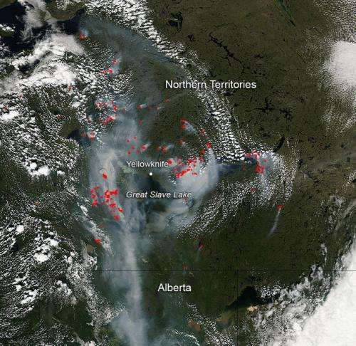
NASA image: Fires and Smoke in Canada's Northern Territories

Environment Canada has issued a high health risk warning for Yellowknife and surrounding area because of heavy smoke in the region due to forest fires. Currently 160 wildfires are burning across the region. There are no plans for evacuation since these fires are endangering people or property. Weather that has been hitting the area recently comes with mixed results. The rains help to dampen the fires, but the lightning tends to start others.
This year the Northern Territories have seen 855,000 hectares (over 2,100,000 acres) burned as opposed to the territories 10 year average of 102,000 hectares (252,000 acres). The number of fires burning are somewhat the same, but the area burned has grown eight-fold this year.
Fire danger in this area remains very high to extreme with no discernable change in that forecast in the near future.
Provided by NASA's Goddard Space Flight Center


