NASA sees fast-developing Tropical Storm Tina

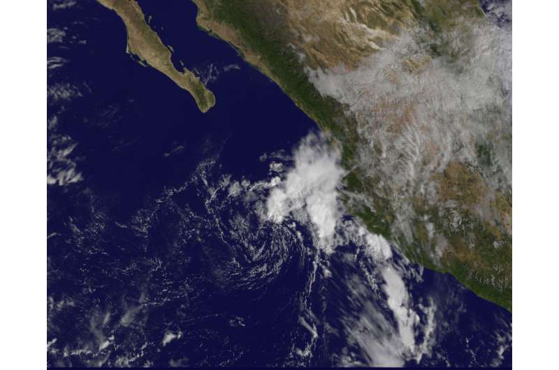
A late-season tropical storm named Tina formed offshore of the southwestern coast of Mexico on Sunday, Nov. 13 at 11 p.m. EST. It developed quickly from a tropical low pressure area previously designated as System 92E. A NASA animation of imagery from NOAA's GOES-West satellite shows Tina's development and weakening to depression status.
At 10 a.m. EST (1500 UTC) on Nov. 14 the center of Tropical Depression Tina was located near 19.0 degrees north latitude and 108.7 degrees west longitude. That's about 285 miles west of Manzanillo, Mexico. The depression is moving toward the west-northwest near 7 mph (11 kph) and the National Hurricane Center forecasts a turn to the west later in the day.
Late on Nov. 13 when the storm formed, maximum sustained winds were up to 40 mph (65 kph), but by 10 a.m. EST on Nov. 14, maximum sustained winds had decreased to near 35 mph (55 kph) with higher gusts.
At NASA/NOAA's GOES Project at the NASA Goddard Space Flight Center in Greenbelt, Maryland, infrared and visible imagery from NOAA's GOES-West satellite was combined to create an animation showing the development of the storm from Nov. 12 to Nov. 14. GOES-West imagery on Nov. 14 showed that the strongest thunderstorms are now confined to a narrow curved band about 90 nautical miles northeast of the center while clouds surrounding the center are sparse.
The National Hurricane Center noted that Tina is expected to produce additional rain accumulations of up to 1 inch over portions of Colima and western Jalisco states in Mexico today, Nov. 14. There are no coastal watches or warnings in effect.
Additional weakening is forecast because very strong southwesterly wind shear of almost 40 knots (46 mph/74 kph) and dry air will continue to affect the cyclone during the next couple of days. Tina is expected to become a remnant low tonight or on Tuesday.
Provided by NASA's Goddard Space Flight Center


