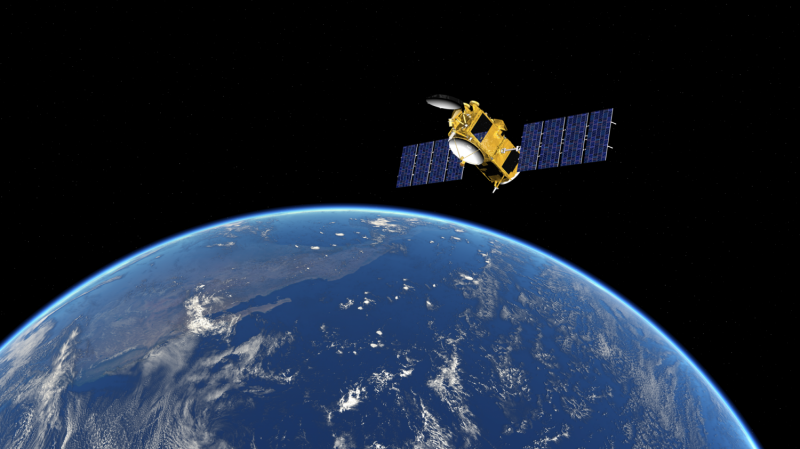
Ocean monitoring satellite Jason-3 ready to take over crucial role

All of the partners in the Jason-3 programme will take part in a live-streamed briefing about the importance of this mission at 16:00 (CEST) on 19 September and will be available to take your questions via Twitter. The live stream will be available via the EUMETSAT website and from partners' websites.
In early October, the ocean-monitoring satellite Jason-3 will take over from Jason-2 as the reference source of high-precision measurements of the global sea surface height from space.
Why should those with an interest in the climate and weather be interested in a satellite "baton passing" occurring 1,336km above the Earth?
Because the Jason satellites, and their precursor Topex/Poseidon, have played and will continue to play an extremely important role in our understanding of the weather, the climate and the impacts of climate change.
Since 1992, they have been taking highly accurate measurements of sea surface height – down to the millimetre - providing information that is not only crucial for weather forecasting models but also an invaluable, long-term, uninterrupted record of changes.
But Jason-2 has been in orbit now for more than eight years, still delivering an excellent mission, and has significantly exceeded its nominal lifespan of five years, so the time is right for Jason-3 to take over.
Jason-3 is expected to ensure this long-term record continues until 2021.
International cooperation
Jason-3, which was launched on 17 January, is an international cooperative project, involving EUMETSAT, the French Space Agency (CNES), the US's National Oceanic and Atmospheric Administration (NOAA) and National Aeronautics and Space Administration (NASA) and the EU, which funds European contributions to the satellite's operations as part of its flagship Earth observation environmental programme, Copernicus. This is the first dedicated altimeter mission to be funded by Copernicus.
"Since its launch on 17 January, Jason-3 has been flying together with Jason-2 in a tandem flight configuration, with each satellite being about 80 seconds or 500km apart," EUMETSAT Altimetry manager François Parisot explains.
"This allows a very precise comparison and direct cross calibration between the instruments flying on both platforms.
Jason-3 takes over from Jason-2
"After more than six months in this configuration, the Jason-3 instruments are now fully calibrated and have demonstrated performances at least equivalent to those of Jason-2. So, Jason-3 can become the reference altimetry mission.
"In order to improve the overall data sampling time and space coverage, Jason-2 will be slightly moved to reach a new position, on the same orbit but at 180° from Jason-3, thus overflying different ocean surfaces and at a different time than Jason-3.
"To achieve this, Jason-2 will be first manoeuvred to an orbit about 10km below or above Jason-3, allowing it to drift in position, then going back to its initial orbit altitude in order to stop this drift at the right time. This overall sequence will take approximately 10 days."
Using Jason-3 data
The primary instrument onboard Jason-3 is its radar altimeter.
The rising sea level is key indicator of climate change, so accurate measurements are crucial. Globally, the sea level has risen 70mm since 1992 but this rise has not been geographically uniform.
Climate researchers need to understand the reasons behind these differences and Jason-3, building on the work of its predecessors, will contribute to this understanding.
Aiding understanding of the climate and climate change is just one of the uses of the data produced by Jason-3, however.
"The height of the oceans is also a measurement of what is happening in the column of water below the place where we take the measurements," Parisot said.
"It helps build a numerical model of the oceans and then this numerical model of the oceans can be coupled with a numerical model of the atmosphere.
"Weather forecasters can use these in the preparation of seasonal forecasts, to give the trends for the weather in the months ahead.
"For these longer term forecasts, it is important to know what is happening in the oceans and Jason-3 will provide this information."
Data from Jason-3's measurements of sea surface height, wind speed and wave height will have numerous applications in the areas of marine meteorology, operational oceanography and climate observation.
The benefits extend beyond more accurate weather forecasting and improved knowledge of the climate and its changes to include, for example, the potential to improve ocean transport safety and understanding of fisheries.
So now Jason-3 will take on a major role in ensuring we have the most accurate information possible about the Earth's oceans.
Planning is already well underway for the next "baton change" when the time comes, with the Jason-Continuity of Service (Jason-CS) programme – a cooperative mission involving Europe, through EUMETSAT, the European Space Agency, CNES and the European Union, and the United States, through NASA and NOAA – under development.
Provided by EUMETSAT


