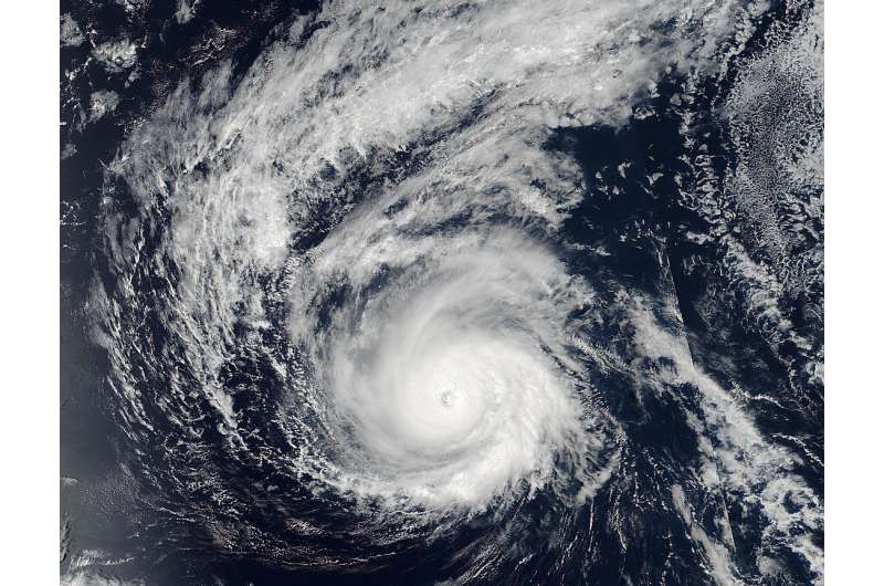
NASA satellite catches major Hurricane Madeline as Hawaii braces

NASA-NOAA's Suomi NPP and NOAA's GOES satellites showed major Hurricane Madeline nearing the Hawaiian Islands. An animation of satellite imagery showed the movement of Madeline and nearby Hurricane Lester over a two day period.
At 7:25 p.m. EDT (23:25 UTC) on Aug. 29, the Visible Infrared Imaging Radiometer Suite (VIIRS) instrument aboard NASA-NOAA's Suomi NPP satellite captured a visible image of major Hurricane Madeline. The storm's eye extended up to 13 nautical miles wide in diameter and Madeline appeared very well organized.
By 11 p.m. EDT (5 p.m. HST) the storm was classified as a major hurricane when maximum sustained winds reached 115 mph (185 kph). Madeline had become a Category 3 hurricane on the Saffir-Simpson Wind Scale.
On Aug. 30, Madeline has sparked a hurricane watch for Hawaii County, Hawaii.
At NASA/NOAA's GOES project office at NASA's Goddard Space Flight Center in Greenbelt, Maryland, an animation of NOAA's GOES-East satellite imagery from Aug. 28 to Aug. 30 was created. The animation showed the movement of Hurricane Madeline intensify from a Category 2 to Category 4 hurricane. To the east of Madeline, Hurricane Lester was moving through the Eastern Pacific Ocean.
At 8 a.m. EDT (2 a.m. HST/1200 UTC), the center of Hurricane Madeline was located near 19.3 degrees north latitude and 147.7 degrees west longitude. That puts the eye of Madeline about 490 miles (790 km) east of Hilo, Hawaii and 680 miles (1,095 km) east of Honolulu, Hawaii.
NOAA's Central Pacific Hurricane Center (CPHC) said that Madeline is moving toward the west near 9 mph (15 kph) and this motion is expected to become west southwesterly late today through early Thursday. On the forecast track, the center of Madeline will pass dangerously close to the Big Island Wednesday and Wednesday night. The estimated minimum central pressure is 950 millibars.
Maximum sustained winds are near 130 mph (215 kph) with higher gusts. Madeline is a category 4 hurricane on the Saffir-Simpson Hurricane Wind Scale. Some weakening is forecast through early Thursday. Hurricane-force winds extend outward up to 30 miles (45 km) from the center and tropical-storm-force winds extend outward up to 125 miles (205 km).
Hurricane conditions are possible over Hawaii County on Wednesday, Aug. 31, and ocean swells are expected to reach the Hawaiian Islands over the next couple of days, possibly becoming damaging along some coastlines Wednesday and Thursday.
NOAA's CPHC said that heavy rains associated with Madeline may reach Hawaii County on Wednesday, and may impact other Hawaiian Islands later Wednesday into Friday. Madeline is expected to produce total rain accumulations of 5 to 10 inches, with isolated maximum amounts near 15 inches, especially over windward portions of the Big Island. This rainfall may lead to dangerous flash floods and mudslides.
Provided by NASA's Goddard Space Flight Center


