NASA's satellites see Fantala intensifying as it moves west

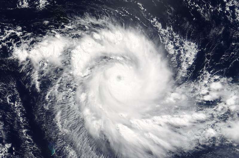
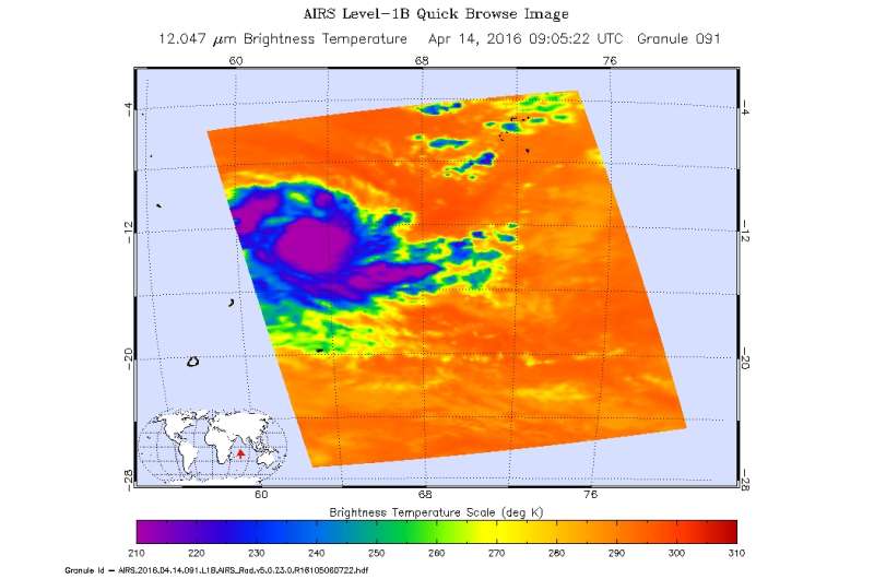
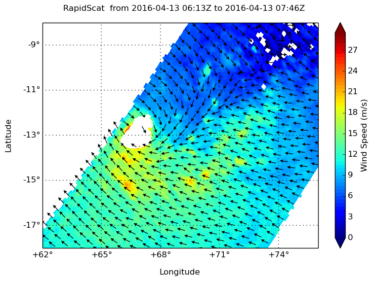
Three different NASA satellites caught images of the storm as it rapidly intensifies and moves west. Currently there are no threatened landmasses in its wake, but it this storm is packing quite a punch. The MODIS and AIRS instruments that fly aboard NASA's Aqua satellite provided visible and infrared data on the storm while the RapidScat instrument that flies aboard the International Space Station looked at the speeds of the surface winds.
Over the course of the last 12 hours before 0900 UTC (5 a.m. EDT) on April 14, Fantala, which is 575 nautical miles northeast of Port Louis, Mauritius, has increased 20 knots (23 mph/37 kph) in wind speed. Fantala is tightly wrapped at present with a very wide open eye of 13 nautical miles (14.9miles/24 km). Wind speeds have been clocked at 105 to 130 knots (120 to 149 mph). On the Saffir-Simpson scale this cyclone would be on the high end of a Category 4 storm. Wave heights around the storm are reaching 30 feet (9.1 meters)
On April 14 at 0905 UTC (5:05 a.m. EDT) NASA's Aqua satellite gathered infrared temperature data on the clouds within the storm. The Atmospheric Infrared Sounder or AIRS instrument found powerful thunderstorms with very cold cloud tops near minus 80 degrees Fahrenheit (minus 62.2 Celsius).

The RapidScat instrument that flies aboard the International Space Station measures Earth's ocean surface wind speed and direction over open waters. Rapidscat measured the wind speeds of Fantala up to 24 meters per second. Surface wind speed is always lower than speeds at higher altitude.
Fantala could be a threat to Madagascar as it heads west towards the island before it turns east and beings moving away from the island nation sometime on April 19 as predicted by the Joint Typhoon Warning Center. The storm is moving at 8 knots (9.2 mph/14.8 kph). The storm is expected to peak at 120 sustained knots today and then adverse conditions at the near-equatorial ridge and midlatitude trough in the Madagascar region will weaken Fantala and the direction of the storm will become southeastward. An interesting note is that the change of the ridge position during El Nino cycles changes tracks of tropical cyclones that form in this area. After four days, the storm will veer southeast sharply as it continues to weaken.

Provided by NASA's Goddard Space Flight Center


