NASA tracking Tropical Storm Oho, south of Hawaii

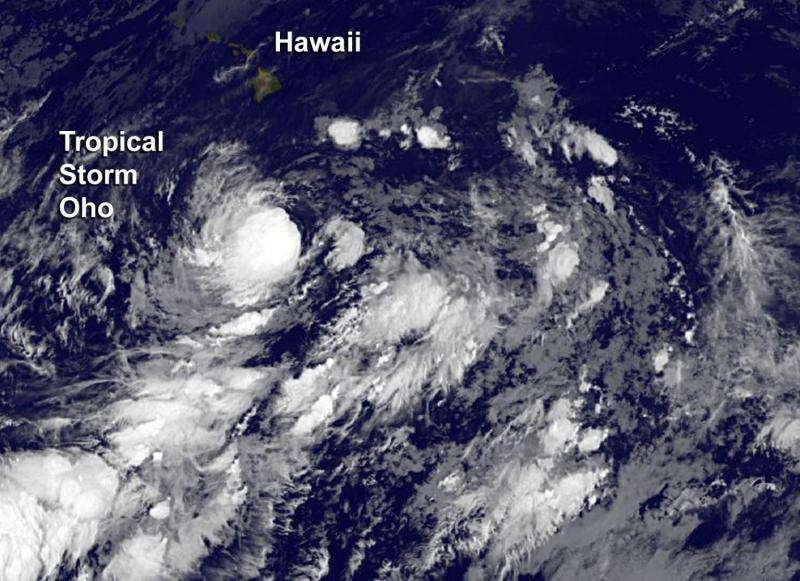
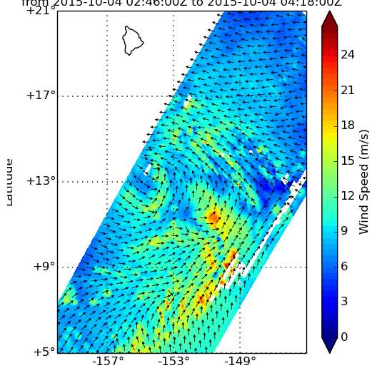
NASA's RapidScat instrument that flies aboard the International Space Station saw that newly formed Central Pacific Ocean Tropical Storm Oho's strongest side was east of its center. By October 5, NOAA's GOES satellite saw a more circular, more uniform circulation.
Tropical Storm Oho formed at 5 a.m. HST/11 am EDT/1500 UTC on October 3, 2015. At that time the center of tropical storm oho was located near latitude 14.2 north and longitude 154.6 west, about 340 miles (545 km) south-southeast of South Point Hawaii.
On Oct. 4 at 0300 UTC (Oct. 3 at 11 p.m. EDT) RapidScat saw Oho's strongest winds were near 21 meters per second (46.9 mph/75.6 kph) on the storm's southeastern side. Tropical storm force winds extended outward up to 115 miles (185 km) from the center.
On Monday, October 6 at 5 a.m. HST/11 a.m. EDT/1500 UTC the center of Tropical Storm Oho was located near latitude 14.1 north and longitude 154.6 west. Tropical Storm Oho is located about 390 miles south of Hilo, Hawaii. NOAA's GOES-West satellite captured an infrared image of the rounded tropical storm south of Hawaii. Oho appeared to be better organized than on the previous day.
Oho was moving slowly toward the north-northeast near 2 mph (4 kph) but it is expected to turn toward the northeast later in the day. Maximum sustained winds were near 50 mph (85 kph) with higher gusts. NOAA's Central Pacific Hurricane Center expects gradual intensification through Tuesday night, October 6. The estimated minimum central pressure is 989 millibars.
CPHC expects Oho to move to the northeast and away from Hawaii. The CPHC long-term forecast takes the system toward the northwestern U.S. as a depression by Saturday, October 10.
To the east of Oho lies another low pressure area located about 815 miles southeast of Hilo, Hawaii. Satellite data has shown that showers and thunderstorms associated with that area of low pressure are have decreased. Environmental conditions are becoming less conducive for significant development over the next two days as it moves slowly north.

Provided by NASA's Goddard Space Flight Center


