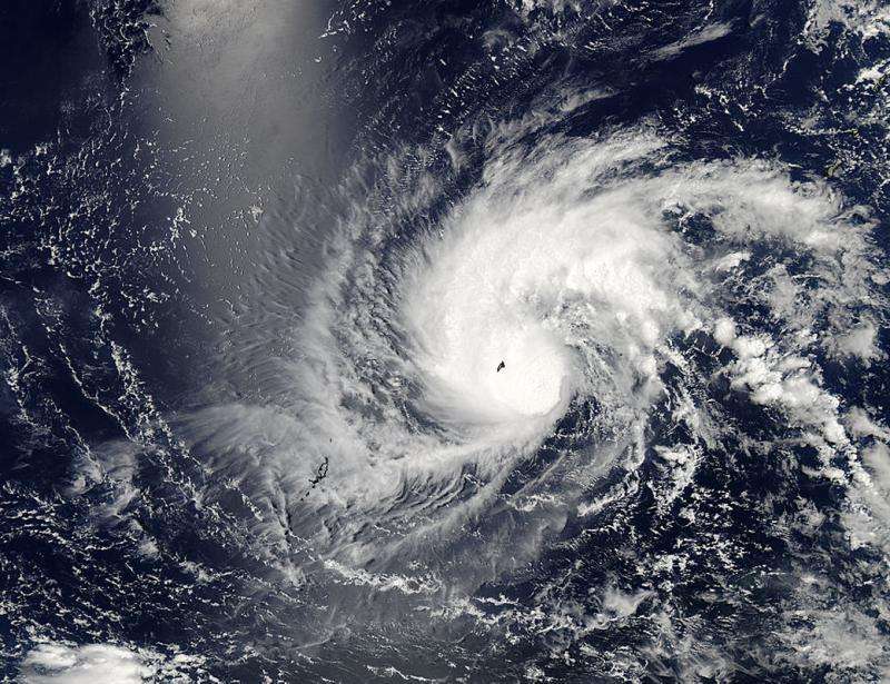
Yap Island typhoon warning in place for Noul

Tropical Storm Noul is still threatening Yap Island located in the Caroline Islands of the western Pacific Ocean, and a part of the Federated States of Micronesia. Micronesia has posted a typhoon warning for the tiny island. The storm is currently 22 miles south-southwest of Ulithi (one of the outer islands of the State of Yap) and is moving west at 2 knots per hour. Maximum sustained winds for the storm is 55 knots gusting to 70 knots and maximum wave height is 20 feet.
Noul is moving to the west and is expected to veer west northwest and later to the northwest. The storm is also expected to intensify to 125 knots over the five days. The projected trajectory has Noul passing northeast of the Phillipine Islands, and potentially passing close to northeastern Luzon, the largest and most populous island in the Philippines.
This is the 10th warning from the Joint Typhoon Warning Center and the next warning is expected at 11:00 am EDT, 1500 GMT.
Provided by NASA's Goddard Space Flight Center


