Land bulge clue to aviation threat from volcanoes

Bulging in land that occurs before a volcano erupts points to how much ash will be spewed into the sky, providing a useful early warning for aviation, geologists in Iceland said on Sunday.
The telltale came from data from Global Positioning System (GPS) sensors placed around the notorious Icelandic volcano Grimsvoetn, they said.
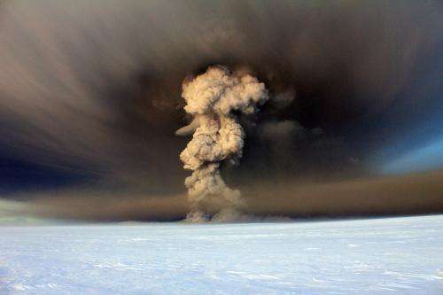
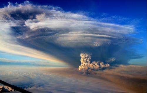
Just before Grimsvoetn blew its stack in May 2011, the ground around the volcano started to bulge.
In a brief but violent eruption, it disgorged a 20-kilometre-high (12-mile) plume of ash, equivalent to 0.27 square kilometres (0.06 cubic miles) of material.
By matching the ground deformation with the volume of the ash, the scientists got a snapshot of conditions that prevailed in the magma chamber below the volcano before the eruption.
The magma chamber is a vessel that progressively fills with injections of molten rock.
When the pressure becomes too great, the magma is expelled through cracks, forming ash as it cools in its passage through the air.
The timing of the eruption and the size of the ash plume depend on several factors within this chamber.
They include the volume of magma, the force at which it is expelled and the resilience of the rock walls of the chamber itself to the mounting pressure.
In the study published in Nature Geoscience, the team, led by Sigrun Hreinsdottir of the Nordic Volcanological Centre in Reykjavik said the magma chamber was about three kilometres (1.9 miles) beneath Grimsvoetn.

The signature from the groundswell points to a drop in pressure about 1.7 kms (1.06 miles) beneath the surface, about an hour before the eruption, as the magma headed upwards.
In volcanoes that are under close surveillance, the method could help warn of imminent eruptions and forecast the possible altitude of ash clouds, the authors said.
"If interpreted in near-real time, these observations could greatly improve forecasting of the onset and evolution of explosive eruptions and volcanic plume height," they said.
Located at the heart of Iceland's biggest glacier, Vatnajoekull, Grimsvoetn is Iceland's most active volcano. Prior to 2011, it had erupted nine times between 1922 and 2004.
The 2011 eruption raised fears of a repeat of the air travel chaos caused by a blast the previous year at the nearby Eyjafjoell volcano, which led to the world's biggest airspace shutdown since World War II, affecting more than 100,000 flights and eight million passengers.
Despite spewing out more ash in 24 hours than Eyjafjoell did in three weeks, Grimsvoetn caused far fewer disruptions.
The eruption swiftly ended, and the number of flights grounded counted in the hundreds.
The study appears in the journal Nature Geoscience.
More information: Paper: dx.doi.org/10.1038/ngeo2044
Journal information: Nature Geoscience
© 2014 AFP


