August 24, 2012 report
New satellite data on melting of Himalayan glaciers
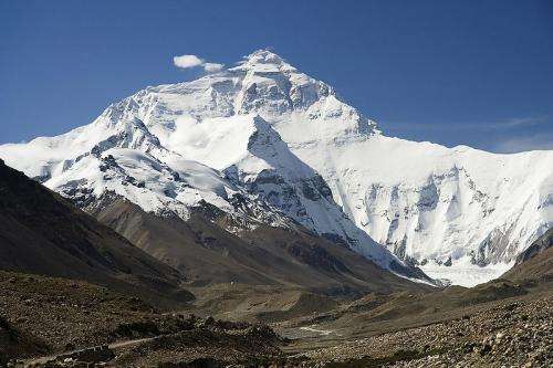
(Phys.org)—There is consensus among scientists that the glaciers in the Himalayas and Tibet are shrinking, but there is disagreement on the extent of the shrinkage because of the difficulty in interpreting satellite data. In 2010 satellite data from the Gravity Recovery and Climate Experiment (GRACE) satellite was analyzed and the researchers concluded the glaciers were losing around 50 billion tonnes of ice each year, but the same data was interpreted earlier this year by another team of researchers who concluded the annual loss of ice was around five billion tonnes.
Now a new study using satellite data from NASA's Ice Cloud and land Elevation satellite (ICESat) combined with radar data collected in 2000 from the space shuttle Endeavour, suggests the loss of ice among the approximately 46,000 glaciers in the Himalayas and Tibet averaged 12 billion tonnes annually between 2003 and 2008. This figure is still around a third lower than estimates from field studies in the region.
Leader of the new study, Prof. Dr. Andreas Kääb, of the University of Oslo in Norway, said that ICESat, launched in 2003, uses a laser altimeter to study the polar ice sheets, which is more suitable for flat terrains than the mountains of the Himalayas. They corrected for this by using measurements of elevation from the space shuttle, and cross-checking elevation measurements of the glaciers against those of adjacent areas to satisfy themselves that reductions in elevation of the glaciers were really caused by loss of ice.
The research team were able to produce a map of the glaciers with a resolution of 70 meters, and showed that over the period of 2003 to 2008 the elevation reduced by an average of 21 centimeters a year.
Professor Kääb noted that glaciers are not all melting at the same rate, and a few are static or even growing. In Karakoram the glaciers are barely changing, while in the north west of India glaciers are melting at the estimated rate of 66 centimeters annually. He also said the studies would need to span several decades to confirm any climate trends.
What the study does do is give scientists a new means of using the ICESat data, and the results also suggest the long-held theory that ice melting is reduced if the glacier has an insulating covering of rocky debris may be wrong, since their results indicate these glaciers (such as Ngozumpa in Nepal) are melting at about the same rate as clean glaciers.
Changes in glaciers in high mountainous regions such as the Himalayas can have marked effects on water resources for the millions of people living in the region and can pose significant hazards through effects such as glacial floods and rock avalanches.
More information: Nature doi:10.1038/nature.2012.11252
Journal information: Nature
© 2012 Phys.Org


