This article has been reviewed according to Science X's editorial process and policies. Editors have highlighted the following attributes while ensuring the content's credibility:
fact-checked
trusted source
written by researcher(s)
proofread
'Cape of Storms': Climate researchers explain Cape Town's recent extreme weather

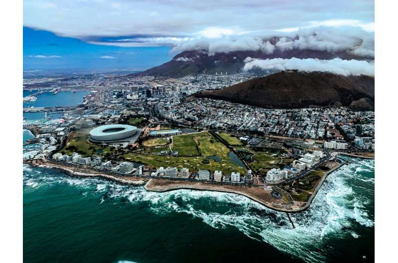
A severe storm hit South Africa's Western Cape province between 6 and 9 April 2024, with extreme winds gusting at up to 135km/h. The storm left a trail of destruction across Cape Town and surrounding areas—at least 1,500 people were left homeless after the high winds fanned fires through their communities, burning homes to the ground.
Sabina Abba Omar and Stefaan Conradie are climate researchers who have studied rainfall variability and weather extremes around Cape Town. They explain some of the factors behind the storms.
What's unique about Cape Town's climate?
Cape Town and the surrounding western coastal belt (the Cape Town region) is the only winter rainfall region in southern Africa. The majority of southern Africa gets rainfall primarily in summer.
In Cape Town's winter, westerly winds bring cold fronts resulting in cold, wet and windy weather. About 70% of the extreme winter rainfall over this area occurs when cold fronts shepherd in atmospheric rivers—long, narrow channels in the air along which enormous amounts of water are transported. They tend to cause extreme rain when they hit mountains.
However, the Cape Town region can also experience extreme storms outside winter. This happens with some of Cape Town's storms that are classified as cut-off lows—isolated wells of cold air in the upper atmosphere which tend to move slowly, often dropping large amounts of rainfall in one place.
Unlike cold fronts, cut-off lows can form at any time of year. Near Cape Town they usually occur with south-easterly winds. They are the most common cause of the "black south-easter" phenomenon—when the south-easter wind, usually associated with fair weather, brings in dark, thick clouds.
Because Cape Town is highly dependent on rain for its water supplies, heavy rains from cut-off lows can also be useful in filling up the city's dams during times of drought. For example, in 2017 there were very few cut-off lows, making 2017 the driest year in the Cape Town region's record, spanning over 100 years.
What severe weather has affected the Cape Town region in the last two years?
A series of severe wind and rain storms occurred in the area in 2022 and 2023.
Extreme rains in December 2022 in isolated parts of the Western Cape were the heaviest since at least 1979, leading to flooded roads and landslides. This was linked to a cut-off low.
In March 2023, a series of cut-off lows brought the wettest March for Cape Town's iconic Table Mountain since at least 1893. Then atmospheric rivers brought widespread, deadly and destructive flooding to the Cape Town region in June, cutting off some communities from the outside world.
Another three months later in September 2023, another cut-off low storm happened, killing at least eight people and causing an estimated R1.4 billion (US$75 million) worth of damage to agriculture alone.
What does the research say?
Research relating climate change to such storms over the Cape Town region is inconclusive.
On the one hand, climate change attribution studies have shown that climate change has intensified extreme rainfall events in many parts of the world. This is because as the Earth warms, more water evaporates from warmer oceans into a warmer atmosphere, capable of holding more moisture. Hence, more rain can fall, more quickly.
The Cape Town region is expected to become drier due to climate change. As a result, attribution studies have identified a significantly increased risk of droughts as bad as the Day Zero event.
The term "Day Zero" was coined by the Western Cape government for the day when water supply to most users would need be cut because the dams would no longer have enough water to supply taps. Since 2016, several such anticipated Day Zero events in South Africa have been narrowly averted.
It would be understandable to think that increasing droughts mean that flooding decreases. However, over the Mediterranean region, whose climate is broadly similar to Cape Town's, climate change is linked to an increased risk of both drought and flooding. This was the conclusion of an attribution study after Storm Daniel caused the world's deadliest flood in decades over coastal Libya.
Another consideration is that cold fronts are expected to weaken and affect South Africa less often in the future. Studies using climate models project a future reduction in extreme rains over Cape Town.
The only study on future climate change and cut-off lows over South Africa concludes that cut-off lows may happen less often. But those that do happen may be wetter. Many questions remain.
Where does this leave us?
More research on the link between Cape Town's storms and climate change is urgently needed. We know that cut-off lows are a major severe weather risk in the area. Better understanding of how cut-off lows may change in the future could help us prepare for their impacts.
The timely and widespread distribution of early warnings issued when such storms are expected is essential. We should all take note of these warnings.
Provided by The Conversation
This article is republished from The Conversation under a Creative Commons license. Read the original article.![]()


