July 21, 2023 report
This article has been reviewed according to Science X's editorial process and policies. Editors have highlighted the following attributes while ensuring the content's credibility:
fact-checked
peer-reviewed publication
trusted source
proofread
Using GPS as a possible earthquake predictor

A pair of seismologists at Côte d'Azur University has found what might turn out to be an accurate way to predict earthquakes. In their study, reported in the journal Science, Quentin Bletery and Jean-Mathieu Nocquet looked at high-rate GPS time series data that was gathered in the time leading up to the moment earthquakes of magnitude 7 or above occurred. Roland Bürgmann with the University of California, Berkeley, has published a Perspectives piece in the same journal issue outlining the work done by the team on this new effort.
Seismologists have long sought to predict earthquakes so that people could react. In many cases, several minutes warning would be helpful—it would allow people to exit buildings that might collapse. Finding a precursor is difficult due to the lack of information regarding what was happening in the vicinity of an epicenter before a quake. In this new effort, Bletery and Nocquet have found a way to go back in time to learn more about land shifting before a big quake.
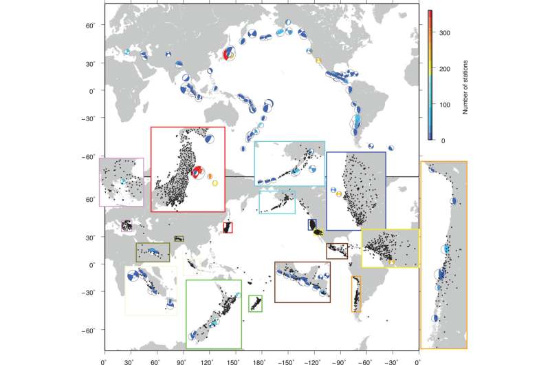
In looking for an earthquake precursor, the researchers obtained and studied precise GPS data for geographical areas surrounding the epicenters of 90 quakes over magnitude 7 over the past several years. They found a pattern—a slip between tectonic plates that caused the land above them to move in a measurable, horizontal direction.
They also found that such slips could be observed and measured using GPS, that they occurred up to two hours before the earthquake struck and were too small to show up on standard seismographs. Most important, they saw the same slip in all the earthquakes they studied.
The work suggests that a reliable earthquake system could be designed based on a precise GPS listening system. On the downside, Bürgmann notes that more work is required to prove that such a precursor exists for all, or at least most, large earthquakes. Also, he adds, some upgrades to GPS technology are required to allow for measuring individual events around the clock.
More information: Quentin Bletery et al, The precursory phase of large earthquakes, Science (2023). DOI: 10.1126/science.adg2565
Roland Bürgmann, Reliable earthquake precursors?, Science (2023). DOI: 10.1126/science.adi8032
Journal information: Science
© 2023 Science X Network


