Mapping our human footprint from space

The world's population is expected to reach 9.7 billion in 2050, according to the UN Department of Economics and Social Affairs. Urban areas are already home to 55% of the world's population and that figure is expected to grow to 68% by 2050. Rapid and unplanned urbanization, combined with the challenges brought by climate change, can lead to an increase in air pollution, higher vulnerability to disasters, as well as issues related to the management of resources such as water, raw materials and energy.
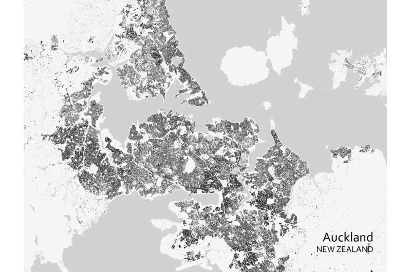
To improve the understanding of current trends in global urbanization, ESA and the German Aerospace Center (DLR), in collaboration with the Google Earth Engine team, are jointly developing the World Settlement Footprint—the world's most comprehensive dataset on human settlement.
The World Settlement Footprint suite consists of several different products, two of which have been publicly released this week during the United Nations Climate Change Conference (COP26) for the Cities, Regions & Built Environment Day: The World Settlement Footprint 2019 (WSF 2019) and the World Settlement Footprint Evolution (WSF Evolution). These products were built using millions of hours of compute time with Google Earth Engine, Google's platform for geospatial data analysis.
The WSF 2019, which provides information on global human settlements with unprecedented detail and precision, features data from the Copernicus Sentinel-1 and Sentinel-2 missions, while the WSF Evolution has been generated by processing seven million images from the US Landsat satellite collected between 1985 and 2015 and illustrates the worldwide growth of human settlements on a year-by-year basis.
This unprecedented collection of global products on human settlement advances our understanding of urbanization on a global scale.
The new World Settlement Footprint products will become an asset for national statistical offices, local authorities, civil society as well as international organizations involved in the implementation of Sustainable Development Goal 11 of the 2030 Agenda on Sustainable Development and the New Urban Agenda. The WSF dataset has proved to be a key resource for analyzing urbanization in developing countries, where often no or poor information is available.
Mattia Marconcini, who manages the World Settlement Footprint from DLR, explains, "Knowing where humans live is deemed easy with freely accessible web services which feature detailed outlines on their platforms. If one starts to focus on low or middle-income countries, particularly in rural and suburban areas, it is immediately clear how information on the overall extent of human settlements is not available for vast parts of the world. This is where the World Settlement Footprint comes in."
"The World Settlement Footprint provides a knowledge base that can support researchers, governmental bodies and other stakeholders such as urban planners to better understand how urbanization is taking place and, concurrently, put in place sustainable urban development strategies for well-informed policy decisions at local and national levels."
ESA's Marc Paganini said, "The availability of continuous data streams of high quality and free of charge satellite observations such as the Sentinels of the European Copernicus program and the Landsat missions, in combination with the emergence of automated methods for large data processing and data analytics, and the democratization of computing costs, offer unprecedented opportunities to efficiently monitor the changes and trends in urban development globally.
"The World Settlement Footprint is a great example on how we can mobilize the data revolution for the benefits of all countries and cities, leaving no one behind, which is one of the leitmotifs of the 2030 agenda on sustainable development."
The new WSF products have received positive feedback from a number of users, who have been granted preliminary access to them, namely the World Bank, Asian Development Bank, UN-Habitat and the International Committee of the Red Cross.
Robert Ndugwa, Chief of the Data and Analytics section of UN-Habitat and the lead of the global urban statistics at UN Habitat, commented, "The World Settlement Footprint Evolution has enabled scalable analysis and computation of spatial urbanization trends not only for individual cities, urban areas, but also on a national and global scale.
"We need to drive towards building sustainable cities and human settlements, and this depends on how well we measure these areas and how well we can predict the growth in all these cities in the future. I believe Earth observation and geospatial technologies give us the tools needed in order for us to grow in this direction."
Sameh Wahba, Director of the World Bank's Urban, Disaster Risk Management, Resilience and Land Global Practice, added, "Big data is extensively used to understand and analyze current development trends, key challenges and future urbanization scenarios across regions. The partnership with ESA, DLR and other organizations over the past years allows us to extend the frontiers of our knowledge and utilize evidence-based data in our decision-making.
"Using the World Settlement Footprint Evolution, our team has been tracking the flood risk exposure of growing cities around the world, such as Bangkok, Thailand. The data suggest that there is a worrying trend we observe: new and unplanned settlements in high-risk flooded areas have grown significantly, especially in low and middle-income countries. The high-resolution data allows us to work with our partners around the world to determine how this risk is evolving and identifying the drivers of such high-risk urban growth."
The World Settlement Footprint 2019 and the World Settlement Footprint Evolution are accessible from the Geoservice portal of DLR's Earth Observation Center.
Provided by European Space Agency


