Infrared NASA imagery finds Chan-hom organizing, consolidating

NASA's Aqua satellite analyzed the large Tropical Storm Chan-hom as it tracked through the Northwestern Pacific Ocean. Aqua imagery showed the storm was consolidating, indicating a strengthening trend.
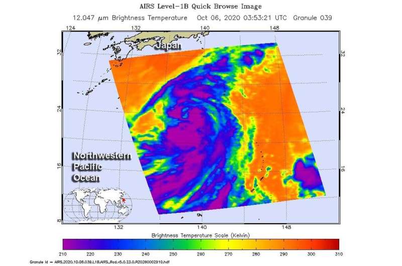
One of the ways NASA researches tropical cyclones is using infrared data that provides temperature information. The AIRS instrument aboard NASA's Aqua satellite captured a look at those temperatures in Chan-hom and gave insight into the size of the storm and its rainfall potential.
Cloud top temperatures provide information to forecasters about where the strongest storms are located within a tropical cyclone. The stronger the storms, the higher they extend into the troposphere, and the colder the cloud top temperatures. NASA provides that data to forecasters at the Joint Typhoon Warning Center so they can incorporate it into their forecasting.
On Oct. 6 at 0353 UTC (Oct. 5 at 11:53 p.m. EDT) NASA's Aqua satellite analyzed Tropical Storm Chan-hom using the Atmospheric Infrared Sounder or AIRS instrument. Forecasters at the Joint Typhoon Warning Center (JTWC) in Honolulu, Hawaii noted that animated enhanced infrared satellite imagery showed the system is consolidating. JTWC noted there has been an improvement in the developing strong bands of thunderstorms wrapping into the low-level center.
AIRS found coldest cloud top temperatures as cold as or colder than minus 63 degrees Fahrenheit (minus 53 degrees Celsius) around the center of circulation. NASA research has shown that cloud top temperatures that cold indicate strong storms that have the capability to create heavy rain.
Despite the consolidation, a microwave image captured at 7:36 a.m. EDT (1136 UTC) indicated that the convective banding remains fragmented.
Chan-hom's Status on Oct. 6
By 11 a.m. EDT (1500 UTC) on Oct. 6, Chan-hom was located near latitude 24.5 degrees north and longitude 137.2 degrees east. It is located approximately 552 nautical miles east-southeast of Kadena Air Base, Okinawa, Japan. It was moving to the west and had maximum sustained winds near 55 knots (63 mph/102 kph).
Chan-hom's Forecast
Chan-hom is forecast to continue consolidating and organizing while it tracks generally to the northwest. It is expected to peak at typhoon strength in two days before weakening again.
Provided by NASA's Goddard Space Flight Center


