Designing today's cities for tomorrow's challenges

Even if you aren't an avid gamer, chances are you've heard of SimCity. Released in 1989 and distinguished by its open-ended gameplay, SimCity gave many players their first taste of full control over a city's development, forever cementing its place in video game history.
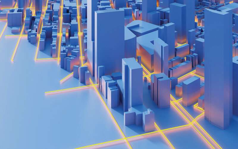
In a curious twist of gameplay to real-life adaptation, virtual city simulations are now allowing urban planners to gain a sense of the outcomes of their decisions without having to build a single physical structure. At a time when the world is being dramatically reshaped by climate change, data-driven modeling of cityscapes is also immensely useful for governments to brace their cities for the worst case scenarios brought on by global warming and rising sea levels.
"Singapore, being a low-lying island with limited land area, is especially vulnerable to climate change," said Hee Joo Poh, a Senior Scientist at the Institute of High Performance Computing (IHPC), A*STAR, citing rising temperatures and ongoing urbanization as threats to the Lion City's livability.
But all is not lost. "By optimizing environmental factors, Singapore's city planners can design housing and infrastructure that maximize the comfort and wellbeing of citizens despite climate change," he quipped.
A bird's eye view of a virtual city
While it is easier to think of climate as being uniform throughout Singapore, the fact is that different parts of the city-state have their distinct climate profiles—known as microclimates. An area's microclimate is affected by a confluence of factors, ranging from natural factors like wind, sunlight and vegetation to manmade elements like building density and vehicular traffic.
Accounting for all these environmental factors in urban planning is a tricky affair, but Poh's research group has created a digital tool called the Integrated Environmental Modeler (IEM) to do just that. Developed in collaboration with colleagues at A*STAR's Institute for Infocomm Research (I2R) and the Building & Research Institute, Housing and Development Board (HDB), Singapore, the IEM leverages multiple data sources to recreate and simulate microclimate scenarios in Singapore. This sets it apart from other environmental modelers on the market that typically only assess one environmental factor at a time.
"The most significant gap that the IEM fills is integration," shared Poh. "It is the first integrated and scalable tool to couple all key environmental physics factors and their complex interactions into a single unified platform."
To create the IEM, the researchers were provided with intricate 3-D geometric data of Singapore by their collaborators at HDB. The team then developed a module that could crunch the 3-D geometric data to transform it into a highly realistic 3-D simulation of the country. At the same time, 43 environmental sensors were deployed in Singapore's eastern half. Powered by the sun, these sensors gathered data on different parameters such as solar irradiance, wind and temperature, wirelessly transmitting the data back to the researchers in real-time.
With vast amounts of data in hand, the researchers then proceeded to perform the painstaking work of combining all the various parameters into what would become the IEM. Data on airflow dynamics, the path of solar heat and noise propagation were overlaid on the 3-D simulation of Singapore, at a ten-meter horizontal resolution. This, admitted Poh, was the most challenging part of the project.
"What we have created is not an integration of existing software, but a system built on a scalable computing architecture using real-time measurements," he said.
When digital gets physical
The value of a tool lies in the problem that it solves for its user. In the case of the IEM, the first problem that Poh's team sought to tackle was a microclimate phenomenon known as the urban heat island effect, which is responsible for the stark difference in temperature between forested and urbanized areas.

Urban heat islands result from the construction of dense urban structures—think skyscrapers and malls— that trap heat along relatively narrow streets. Coupled with a lack of shade-providing vegetation and heat from vehicular traffic, temperatures in these heat islands can soar to unbearable levels.
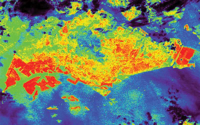
Unsurprisingly, satellite data has revealed that urban heat islands are more apparent in Singapore's highly urbanized south. Areas like the Tuas Industrial Park and Changi Airport are also particularly warm due to the large swaths of exposed concrete and metal found at these sites. Meanwhile, the forested north is comparatively cooler during the day—the researchers reported a temperature difference of 4°C between well-planted areas and Singapore's Central Business District.
By combining these temperature differences in tandem with computational fluid dynamics (CFD) simulations of wind speed and direction, as well as the presence or absence of vegetation and water bodies in an area, the researchers were able to identify optimal locations to build amenities such as playgrounds in existing or new developments. Furthermore, by taking noise data into consideration, the researchers were able to identify a link between heat distribution and noise propagation in urban settings.
"Sound travels faster in warmer air, so when the air above the earth is warmer than the air at the surface, the sound wave bends back towards the earth," Poh explained. "Under such circumstances, the downward refraction may allow sound to travel over obstacles such as noise barriers and propagate further."
Such insights could be useful for Singapore's urban planners as more high-rise buildings are being built near expressways to maximize land usage. The height and location of noise barriers may also have to be adjusted to limit the extent of noise pollution experienced by the buildings' inhabitants.
Building on a strong foundation
Analogous to how Singapore's skyline is in a state of constant flux, the IEM remains a work in progress as Poh and colleagues continue to make improvements to the simulations.
"The long-term vision for the IEM tool is to morph it into a highly accurate "Digital Twin' model for use with any urbanized area, capable of accounting for various factors affecting urban environments," said Poh. "This reduces the risk of costly physical trial-and-error and allows development plans to be tested computationally before actual implementation."
Even the features of individual buildings can be assessed in silico using the IEM, Poh added, highlighting how he has worked with the Building and Construction Authority (BCA) of Singapore for more than a decade on climate-responsive building design, contributing his expertise on CFD simulations.
"In 2008, BCA included CFD in its initiative (the BCA Green Mark Scheme) to drive Singapore's construction industry towards more environmentally friendly buildings, and I was engaged as an external assessor for projects under the initiative," he said. Then in 2012, he further collaborated with BCA to develop CFD simulation methodology and evaluation parameters for modeling naturally ventilated spaces in non-residential buildings under the Green Mark criteria.
For his contribution to the field of urban livability and sustainability in Singapore, Poh was honored by the Ministry of National Development (MND) as a World Cities Summit Young Leader in 2014. More recently, in 2019, Poh, along with Wee Shing Koh from IHPC, Fachmin Folianto from I2R and Sze Tiong Tan from HDB, were awarded the President's Technology Award 2019—Singapore's most prestigious science and technology award—for their work on the IEM.
"Our research helps bring innovative solutions for sustainable cities planning and design, but beyond the field of urban planning, climate scientists and environmental researchers could also use the IEM to simulate and study the localized effects of future global climate change," Poh said.
"The findings from such studies would be useful for government agencies to formulate policies and put in place measures to mitigate climate-related threats," he concluded.
More information: H. J. Poh, et al. Modeling of Urban Heat Island and Noise Propagation in Singapore. 4th International Conference on Countermeasures to Urban Heat Island, National University of Singapore (2016)


