Barbara now a major hurricane on NASA satellite imagery

NASA's Terra and Aqua satellites passed over the Eastern Pacific Ocean after Tropical Storm Barbara strengthened into the first hurricane of the season. Barbara intensified rapidly into a major hurricane.
NOAA's National Hurricane Center (NHC) noted that Barbara intensified early during the morning of July 2 and could strengthen a little more. Fortunately, Barbara is over 1,000 miles west of the southern tip of Baja California, and there are no coastal watches or warnings in effect.
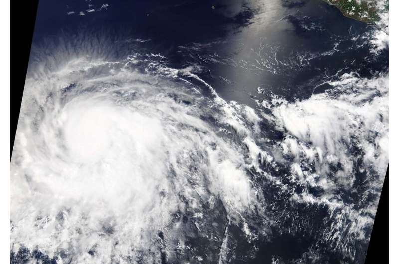
On July 2, the Moderate Resolution Imaging Spectroradiometer or MODIS instrument aboard NASA's Terra satellite provided a visible image of Barbara that showed powerful thunderstorms circling an eye. Bands of thunderstorms wrapped into the center from the southern and eastern quadrants.
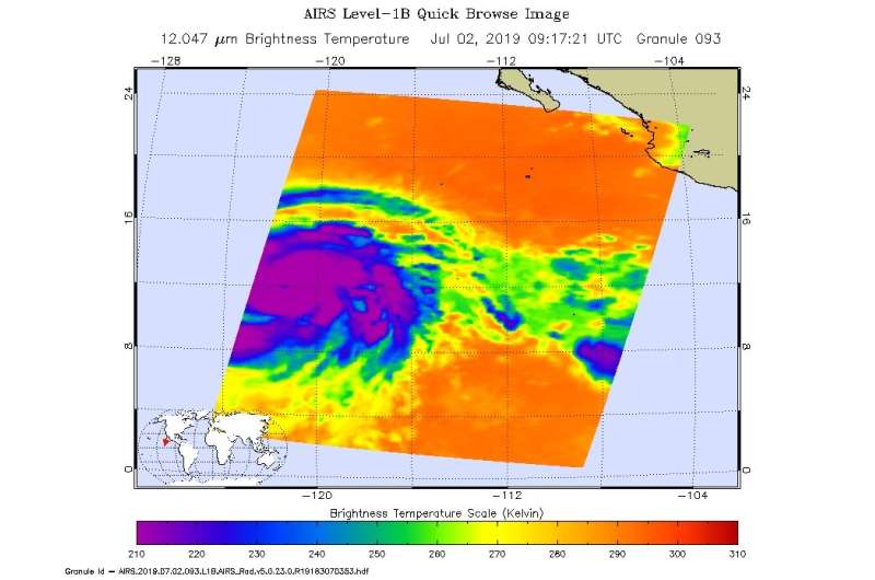
An infrared look by NASA's Aqua satellite on July 2, at 5:17 a.m. EDT (0917 UTC revealed where the strongest storms were located within Hurricane Barbara. The Atmospheric Infrared Sounder or AIRS instrument aboard NASA's Aqua satellite analyzed cloud top temperatures and found cloud top temperatures of strongest thunderstorms as cold as or colder than minus 81.6 degrees Fahrenheit (minus 63.1 degrees Celsius) circling the eye, which was seen in a lighter color in a false-colored NASA image. Cloud top temperatures that cold indicate strong storms that have the capability to create heavy rain.

At 11 a.m. EDT (1500 UTC), the NHC noted the eye of Hurricane Barbara was located near latitude 12.5 degrees north and longitude 122.2 degrees west. Barbara is about 1,080 miles or 1,740 km southwest of the southern tip of Baja California, Mexico. Barbara is moving toward the west-northwest near 14 mph (22 kph). Barbara is forecast to slow in forward speed later today and then turn toward the northwest in a day or two. The estimated minimum central pressure is 948 millibars (28.00 inches).
Satellite data indicate that the maximum sustained winds have increased to near 130 mph (215 kph) with higher gusts. Barbara is a category 4 hurricane on the Saffir-Simpson Hurricane Wind Scale. Hurricane-force winds extend outward up to 25 miles (35 km) from the center and tropical-storm-force winds extend outward up to 185 miles (295 km).
Some additional strengthening is possible today, but weakening is likely to begin on Wednesday and continue into Thursday.
Provided by NASA's Goddard Space Flight Center


