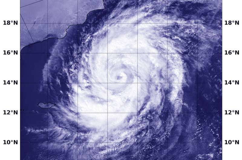
Satellite sees Tropical Cyclone Luban nearing Oman

Tropical Cyclone Luban continued to move through the Arabian Sea toward the coast of Oman when the NOAA-20 satellite provided a visible image of the storm.
NOAA-20 passed over Luban on Oct. 10 at 5:24 a.m. EDT (0924 UTC) and the VIIRS instrument provided a visible image. The VIIRS instrument also flies aboard NASA-NOAA's Suomi NPP satellite. The VIIRS image showed Luban had developed an eye that was surrounded by powerful storms. The Joint Typhoon Warning Center noted "Animated enhanced infrared satellite imagery shows the system has maintained deep central convection with spiral bands wrapped tightly toward the center."
At 11 a.m. EDT (1500 UTC) Tropical cyclone Luban was located near 14.4 degrees north latitude and 58.5 degrees east longitude. That's about 298 nautical miles east-southeast of Salalah, Oman. Luban is moving to the west-northwest and has maximum sustained winds near 75 knots
Luban is forecast to maintain current strength as it moves northwest, later to the west. The storm is expected to weaken before approaching the coast of Yemen. Luban is forecast to make landfall east of Mukalla, and dissipate inland.
Provided by NASA's Goddard Space Flight Center


