NASA tracking Hurricane Maria on Bahamas approach

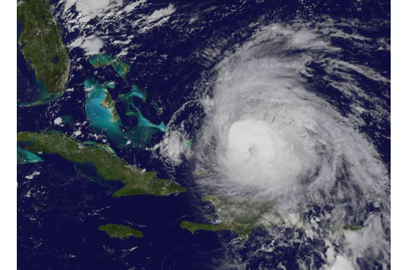
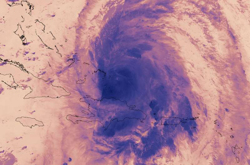
NASA-NOAA's Suomi NPP satellite provided a look at Maria's temperatures to find the strongest sides of the storm, while NOAA's GOES satellite revealed the extent of the storm in a visible image as it moved toward the Bahamas.
On Sept. 22 at 3:18 a.m. EDT (0718 UTC) the VIIRS instrument aboard NASA-NOAA's Suomi NPP satellite provided a thermal image of Hurricane Maria north of Hispaniola and nearing the Bahamas. The image showed highest coldest clouds around the eyewall and in bands of thunderstorms to the northeast and south and southeast of the center, stretching over Hispaniola and Puerto Rico. Those clouder clouds have the capability of producing heavy rainfall.
At 5:04 a.m. AST/EDT the National Weather Service (NWS) in San Juan, Puerto Rico reported those bands of thunderstorms were still dropping heavy rain. Satellite estimates indicate heavy rain over eastern Puerto Rico and heavier rain about to move into western Puerto Rico. The heavy rain will cause flooding. NWS noted "Some locations that are or will experience flooding include San Juan, Ponce, Arecibo, Yauco, Fajardo, Guayama, Coamo, Jayuya, Adjuntas, Santa Isabel, Canovanas, Sabana Seca, San Sebastian, Naranjito, Humacao, Mayaguez, San German, Lajas, Hatillo and Penuelas." Flood warnings are in effect until 5:45 p.m. EDT today, Friday, September 22, 2017. In hilly terrain there are hundreds of low water crossings which are potentially dangerous in heavy rain.
A visible image of Hurricane Maria was taken from NOAA's GOES East satellite on Sept. 22 at 10 a.m. EDT (1400 UTC) showed the storm just north of Turk Island and nearing the Bahamas. The National Hurricane Center (NHC) reported "Maria is still producing 125-mph winds as it passes northeast of the Turks and Caicos Islands.

Both the Suomi NPP and GOES East images were created at NASA's Goddard Space Flight Center in Greenbelt, Md. NOAA manages the GOES series of satellites and the NASA/NOAA GOES Project uses the data to create images and animations. The Rapid Response Team at Goddard produces imagery from the Suomi NPP satellite.
A Hurricane Warning is in effect for Turks and Caicos Islands and the Southeastern Bahamas and a Tropical Storm Warning is in effect for the Central Bahamas.
At 11 a.m. EDT (1500 UTC), the eye of Hurricane Maria was located near 22.3 degrees north latitude and 71.0 degrees west longitude. That's about 55 miles (90 km) north of Grand Turk Island, and 445 miles (715 km) east-southeast of Nassau. Maria was moving toward the northwest near 8 mph (13 kph).
Data from an Air Force Reserve Hurricane Hunter aircraft indicate that maximum sustained winds remain near 125 mph (205 kph) with higher gusts. Maria is a category 3 hurricane on the Saffir-Simpson Hurricane Wind Scale. A gradual weakening is forecast during the next 48 hours. The minimum central pressure based on data from the reconnaissance aircraft is 958 millibars.
NHC said a turn toward the north-northwest is expected later today, followed by a turn toward the north by late Saturday. On the forecast track, Maria's core will move away from the Turks and Caicos Islands today, and pass northeast and east of the Bahamas through Sunday, Sept. 24.
Provided by NASA's Goddard Space Flight Center


