NASA sees intensifying Tropical Cyclone Ella now heading west

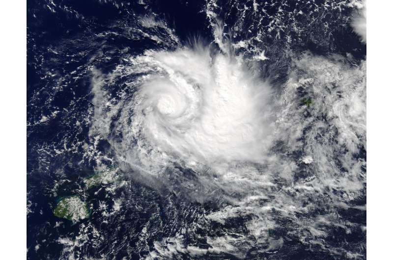
Tropical Cyclone Ella is intensifying and NASA observed heavy rainfall in the storm. Ella is now expected to pass to the north of Fiji which is good news for the island nation.
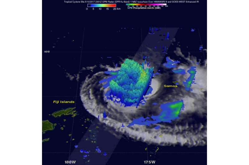
The Global Precipitation Measurement mission or GPM core observatory satellite flew over intensifying Tropical Cyclone Ella in the South Pacific on May 10, 2017 at 2301 UTC (7:01 p.m. EDT). The satellite's Microwave Imager (GMI) and Dual-Frequency Precipitation Radar (DPR) instruments showed bands of curved rainfall bands wrapping into the center of a well-defined center of circulation. GPM's DPR measured rain falling at a rate of over 231 mm (9.1 inches) per hour in an intense feeder band on Ella's eastern side. GPM is a joint mission between NASA and the Japanese space agency JAXA.
At NASA's Goddard Space Flight Center in Greenbelt, Maryland, a 3-D view of Tropical Cyclone Ella was produced using GPM radar reflectivity data (DPR Ku Band). DPR showed that the highest storm tops around the intensifying tropical cyclone were located in intense storms in the feeder band on Ella's eastern side. Some of these powerful storms were found by GPM's DPR to reach altitudes above 15.5 km (9.6 miles).
On May 11 at 1500 UTC (11 a.m. EDT), Ella's maximum sustained winds had increased to 70 knots (80 mph/129.6 kph).The center of Ella was located about 324 nautical miles northeast of Suva, Fiji near 13.7 degrees south latitude and 178.7 degrees west longitude. Ella was moving to the west at 4 knots (4.6 mph/7.4 kph).
Fiji has a strong wind warning in effect for Vanua Levu, Taveuni and nearby smaller islands and Northern Lau Group.
The Joint Typhoon Warning Center (JTWC) noted that animated enhanced infrared satellite imagery showed Ella was a compact system with a small central dense overcast. Ella has tightly curved thunderstorm banding wrapping into a small microwave eye feature along the northwest edge of the central convection.
JWTC forecasts that Ella will move west and stay to the north of Fiji. The storm is at peak intensity and will gradually weaken, until it dissipates within about four days.

Provided by NASA's Goddard Space Flight Center


