NASA sees another quick Tropical Cyclone demise in South Pacific

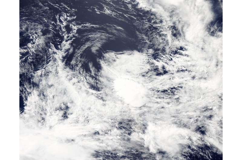
NASA's Aqua satellite captured an image of the end of Tropical Cyclone 8P as it was being sheared apart by strong vertical wind shear.
Tropical Cyclone 8P "lived and died" within two days in the Southern Pacific Ocean like Alfred and Bart before it. Wind shear was responsible for the quick demise of Bart, while landfall was the reason Alfred fizzled so quickly.
The Moderate Resolution Imaging Spectroradiometer or MODIS instrument aboard NASA's Aqua satellite captured a visible image of 8P on Feb. 22 at 2145 UTC (4:45 p.m. EST). The MODIS image showed strong northwesterly wind shear pushed the bulk of clouds and showers south of the center of circulation.
On Feb. 22 at 4 p.m. EST (2100 UTC) the Joint Typhoon Warning Center or JTWC noted 8P's maximum sustained winds were near 40 mph (35 knots/62 kph). At that time, 8P was centered near 26.6 degrees south latitude and 163.7 degrees west longitude, about 388 nautical miles south-southwest of Tonga. 8P was moving to the southeast at a speedy 40 mph (35 knots/62 kph) and over open waters of the South Pacific Ocean.
In their final warning on the system, the JTWC noted that 8P had become extra-tropical.
Provided by NASA's Goddard Space Flight Center


