Connecting space to village in West Africa

The Earth Institute's Center for International Earth Science Information Network (CIESIN) and International Research Institute for Climate and Society (IRI) are providing technical assistance for geospatial product and service development for the new SERVIR hub in West Africa. SERVIR, a joint initiative of NASA and the U.S. Agency for International Development (USAID), is an environmental monitoring program that enhances the role of space-based observations in the management of climate-sensitive issues facing the world today.
SERVIR-West Africa, based in Niamey, Niger, is one of four SERVIR hubs operating in developing regions of the world. This SERVIR center is the newest facility for a growing global community of scientists and decision-makers who are using publicly available data from space to manage climate-sensitive issues, such as food security, water resources, land use change and natural disasters.
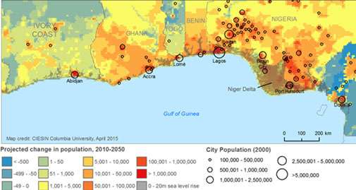
West Africa is a data-poor and highly climate-sensitive region that can greatly benefit from space-based measurement. CIESIN and IRI have been pioneers in deploying remote sensing and geospatial tools for climate vulnerability mapping and climate services in West Africa and other developing regions. Also, both CIESIN and IRI have worked under USAID funding on climate resilience projects in Africa, and CIESIN has worked with NASA since its founding in 1989 through its management of the NASA Socioeconomic Data and Applications Center (SEDAC).
Teams of scientists at SERVIR-West Africa will draw on space-based climate, weather, land cover, and other data from NASA's constellation of Earth observing satellites, sharing timely information with policy makers, government agencies and other stakeholders in Ghana, Burkina Faso, Senegal and Niger to address critical regional issues such as food security and the availability of fresh water.

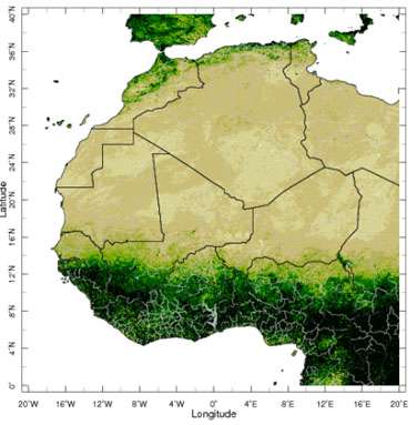
SERVIR-West Africa is funded by USAID and NASA and implemented by the Agriculture, Hydrology, and Meteorology (AGRHYMET) Regional Center, headquartered in Niamey. This center will implement this program together with a consortium of West African partners with support from Tetra Tech/ARD. CIESIN and IRI serve as technical subcontractors to Tetra Tech/ARD. In parallel, NASA SERVIR's Applied Sciences Team has announced its support of an IRI project entitled, "Desertification or Re-Greening? Adaptation Lessons Learned in Coping with Late 20th Century Drought in West Africa."
SERVIR's global network of leading regional knowledge centers also includes the Regional Center for Mapping of Resources for Development in Nairobi, Kenya, serving eastern and southern Africa; the International Centre for Integrated Mountain Development in Kathmandu, Nepal, serving the Hindu-Kush-Himalaya region; the Asian Disaster Preparedness Center in Bangkok, Thailand, serving the lower Mekong region of Southeast Asia; and other partners dedicated to environmental management through the integration of Earth observations and geospatial technologies.
SERVIR is a joint NASA-USAID development initiative that operates internationally in partnership with leading regional organizations to help train developing countries in the use of data from space to become better stewards of the planet and its resources, while also meeting societal needs. Programs in each region focus on issues and needs most critical to their local populations.
Provided by Earth Institute, Columbia University


