Buoy data to inform how aquaculture fits into working waterfront

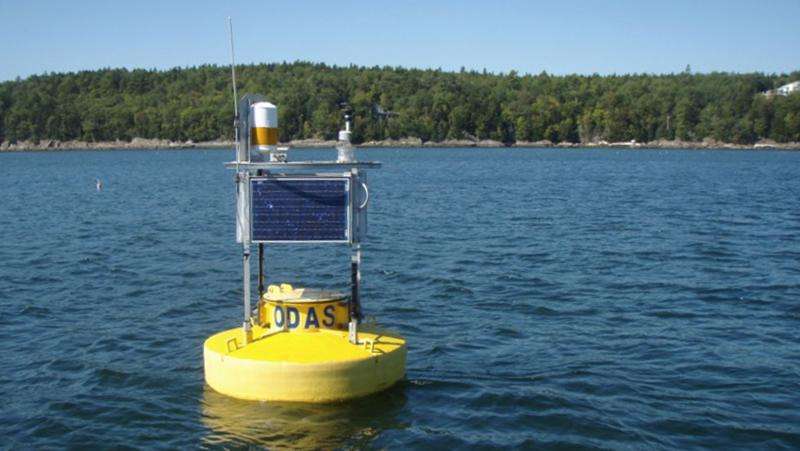
University of Maine scientists have deployed an ocean-observing buoy at the mouth of the Damariscotta River to help scientists understand how different types and scales of aquaculture can fit into Maine's multi-use working waterfront.
The buoy is part of a National Science Foundation's Sustainable Ecological Aquaculture Network (SEANET) project geared to assist the aquaculture sector maintain an environmentally and economically sustainable production path.
Professor Neal Pettigrew's Physical Oceanography Group in the School of Marine Sciences will use data gathered by Mooring E0501 to map water circulation at the mouth of the river.
The detailed circulation patterns will be integrated into ecosystem models under the supervision of Damian Brady, assistant research professor at the Darling Marine Center. The models will include results of environmental monitoring, field investigations and lab analysis, much of which will be conducted at the DMC.
The letters ODAS on the buoy stand for the Ocean Data Acquisition System. The buoy, designed and constructed by Ocean Science and Technology, LLC., includes technology developed for the network of deep-water buoys in the Gulf of Maine that are part of the Northeastern Regional Association of Coastal and Ocean Observing Systems.
Powered by solar panels and batteries, Mooring E0501 records air temperature, wind strength and direction, wave height, water temperature, salinity, concentrations of phytoplankton and current speed and direction at several depths between the surface and 20 meters (65 feet).
Researchers plan to maintain the buoy through next fall to capture the annual cycle and dynamic interaction of the ocean-bound Damariscotta River and the landward push of the ocean tides.
Data is telemetered to shore in almost real time by a cell phone modem and can be viewed at the Physical Oceanography Group's website.
Much of the data is graphically represented. For instance, it shows the fastest current runs north to south on the ebb tide when it reaches nearly 1.5 miles per hour and shows a recent increase in salinity.
Provided by University of Maine


